

Photo by Vincent FOURNEAU on Unsplash
Water scarcity in the Middle East and North Africa (MENA) is a paramount issue, deeply rooted in the region's geographical and climatic characteristics. These arid and semi-arid regions face significant challenges in managing its limited freshwater resources amidst burgeoning populations, economic development, and geopolitical tensions. The geopolitics of water in the Middle East encompasses a complex web of historical rivalries, contemporary disputes, and strategic considerations that shape the interactions between states and within communities.
The historical backdrop of water resource management in the Middle East is deeply intertwined with the rise and fall of ancient civilizations, particularly those that thrived along major river systems. The Tigris and Euphrates rivers, forming the lifeblood of Mesopotamian civilizations, have played a crucial role in sustaining agriculture, supporting population growth, and fostering economic development. The Sumerians, Akkadians, Babylonians, and Assyrians constructed elaborate irrigation systems to harness the water of these rivers, underpinning their agricultural surpluses and urbanization. For instance, the ancient city of Uruk, with an estimated population of 50,000 by 2900 BCE, relied heavily on these irrigation techniques. Similarly, the Indus Valley Civilization in present-day Pakistan and northwest India developed sophisticated water management systems, including drainage, irrigation, and reservoirs, to support their agricultural activities and urban centers.
Nile river
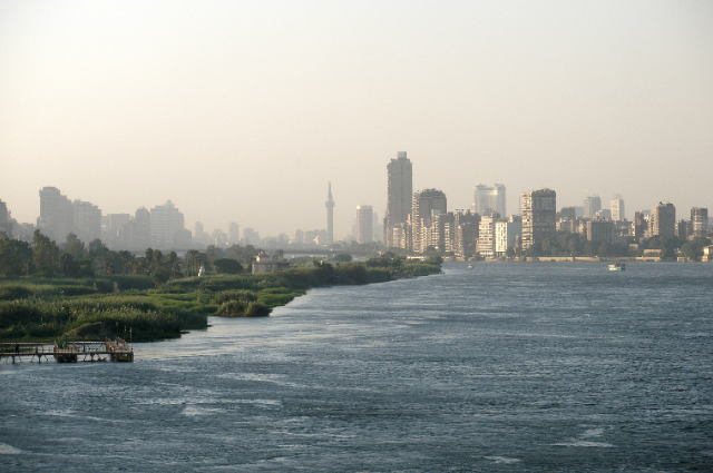
The Nile River Basin, encompassing 11 countries including Egypt, Sudan, and Ethiopia, is another critical hotspot for water geopolitics. Egypt, which relies on the Nile for 97% of its freshwater, has historically maintained a hegemonic position over the river's waters, underscored by colonial-era agreements that allocated the bulk of the Nile's flow to Egypt and Sudan. However, upstream countries, particularly Ethiopia, have increasingly asserted their rights to utilize the Nile's waters for their development needs. The Aswan High Dam, created in the 1960s, standing at 111 meters high and 3,830 meters long, created Lake Nasser, one of the world's largest artificial lakes, with a storage capacity of 132 cubic kilometres.
However, it also led to significant ecological and socio-economic consequences, including the displacement of approximately 100,000 Nubians and the loss of fertile sediment downstream. The construction of the Grand Ethiopian Renaissance Dam (GERD), which began in 2011, has heightened tensions between Egypt, Sudan, and Ethiopia. The GERD, poised to be Africa's largest hydroelectric dam with a capacity of 6,450 megawatts, is expected to significantly alter the flow of the Blue Nile, a major tributary of the Nile. Ethiopia views the GERD as a vital project for its energy security and economic development, with the potential to lift millions out of poverty by providing electricity to over 65 million Ethiopians who currently lack access.
Egypt, however, fears that the dam will reduce its share of the Nile's water, threatening its agricultural sector, which employs approximately 30% of the workforce and contributes 12% to the GDP. The Nile Delta, home to nearly half of Egypt's population and responsible for over 60% of its agricultural production, is particularly vulnerable to reduced water flow and rising sea levels. Sudan's hydroelectric power generation, primarily dependent on the Nile, is also at risk due to the GERD. Dams such as the Roseires Dam and the Merowe Dam contribute significantly to Sudan's electricity supply. However, changes in water flow from the GERD could affect Sudan's ability to generate electricity, leading to potential energy shortages and impacting industries and infrastructure.
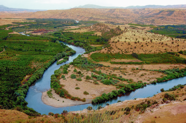
The confluence of the Blue and White Nile rivers in Khartoum, Sudan, is a critical juncture for the Nile River Basin, influencing the water politics of Egypt, Sudan, and Ethiopia. The Blue Nile, originating in Ethiopia's Lake Tana, contributes about 80% of the Nile's flow, while the White Nile, originating in the Great Lakes region of Central Africa, provides a more stable year-round flow. The confluence at Khartoum creates the main Nile, flowing northwards through Sudan and Egypt to the Mediterranean Sea.
Jordan River
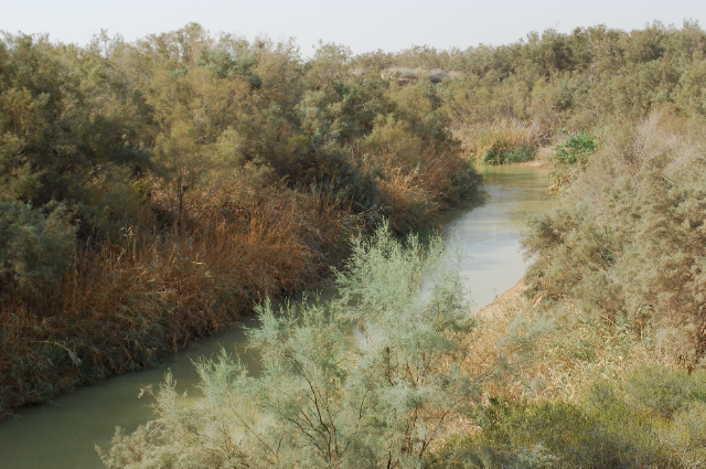
The Jordan River Basin, shared by Israel, Jordan, Lebanon, Syria, and Palestine, epitomizes the geopolitical complexity of water resources in the Middle East. Originating from the confluence of the Hasbani, Banias, and Dan rivers near the Sea of Galilee, the Jordan River flows southward, forming the border between Jordan and Israel, before emptying into the Dead Sea. The river's annual flow has diminished from more than 1.3 billion cubic meters in the early 20th century to approximately 400 million cubic meters today, primarily due to extensive water diversion projects. Israel's National Water Carrier, completed in 1964, diverts water from the Sea of Galilee to the densely populated coastal plains and the Negev Desert, significantly reducing the river's flow downstream.
Jordan, one of the world's most water-scarce countries, relies heavily on the Jordan River and its tributaries. The country's per capita water availability has plummeted from 3,600 cubic meters annually in 1946 to less than 150 cubic meters today, well below the threshold for absolute water scarcity. The Disi Water Conveyance Project, completed in 2013, aims to alleviate some of Jordan's water stress by transporting water from the Disi aquifer in southern Jordan to Amman, providing up to 100 million cubic meters annually. However, this project has raised concerns about the sustainability of the Disi aquifer, which is a non-renewable fossil water source.
The Palestinian territories, particularly the West Bank and Gaza Strip, face severe water challenges exacerbated by the Israeli-Palestinian conflict. The Oslo II Accord of 1995, which established a framework for water resource management, has been criticized for perpetuating inequitable water distribution. Palestinians in the West Bank receive an average of 73 liters per capita per day, compared to 300 liters for Israelis. In Gaza, the situation is dire, with 97% of the coastal aquifer's water deemed unfit for human consumption due to over-extraction and contamination, leading to a public health crisis.
Tigris and Euphrates
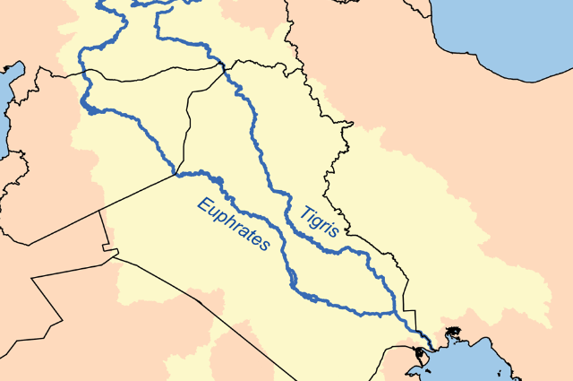
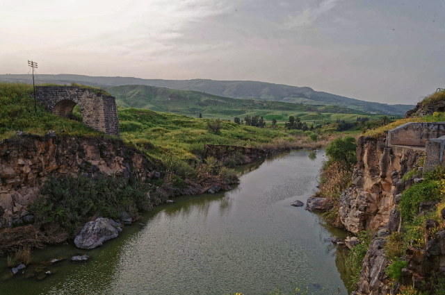
The Tigris and Euphrates rivers, originating in Turkey and flowing through Syria and Iraq, are central to regional water politics. Originating in the Taurus Mountains in Turkey, the Tigris flows southeastward through Iraq, joining the Euphrates near the Shatt al-Arab River, which empties into the Persian Gulf. The Tigris River basin covers an area of approximately 375,000 square kilometers and is crucial for agriculture, domestic water supply, and transportation. The river supports a population of over 30 million people, providing water for irrigation, drinking, and industrial use. Originating in the Taurus Mountains in Turkey, the Euphrates flows southeastward through Syria and Iraq, joining the Tigris near the Shatt al-Arab River, which empties into the Persian Gulf. The Euphrates River basin covers an area of approximately 444,000 square kilometers and is crucial for agriculture, domestic water supply, and transportation. The river supports a population of over 50 million people, providing water for irrigation, drinking, and industrial use.
Turkey's ambitious Southeastern Anatolia Project (GAP), which includes the construction of 22 dams and 19 hydroelectric power plants, aims to irrigate 1.7 million hectares and generate 27 billion kilowatt-hours of electricity annually. However, this project has significantly reduced the downstream flow of the Tigris and Euphrates, leading to acute water shortages in Syria and Iraq. For instance, the Euphrates' flow into Iraq has decreased from 30 billion cubic meters per year in the 1970s to less than 20 billion cubic meters in recent years. The impact of water scarcity is evident in the shrinking of the Dead Sea, a unique natural wonder shared by Israel, Jordan, and Palestine. The Dead Sea's water levels have been declining at an alarming rate, primarily due to the diversion of water from the Jordan River for agricultural and domestic use, as well as mineral extraction activities. The shrinking of the Dead Sea has led to the formation of sinkholes, posing a significant threat to infrastructure and communities in the region.
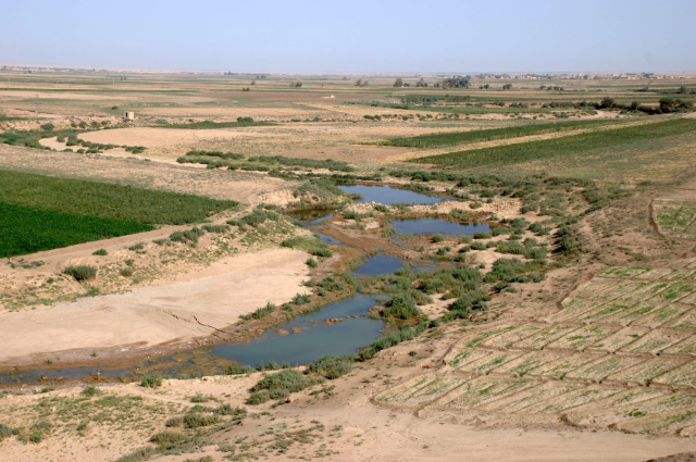
Iraq, heavily reliant on the Tigris and Euphrates for its water resources, has experienced severe droughts and declining agricultural productivity due to upstream water diversion. The Mesopotamian Marshes, a unique wetland ecosystem at the confluence, have also been significantly affected, leading to environmental degradation and the displacement of the Marsh Arabs, a community with a cultural heritage dating back millennia. The marshes, once covering up to 20,000 square kilometres, have shrunk to less than 4,000 square kilometres in some years due to water scarcity.
The Shatt al-Arab waterway's strategic importance for oil exports cannot be overstated. Iraq's Basra province is home to the country's largest oil fields, and the waterway serves as a critical route for oil tankers. Control over this waterway has been a point of contention between Iraq and Iran, leading to military clashes and territorial disputes. The 1980-1988 Iran-Iraq War saw significant battles over the Shatt al-Arab, with both nations vying for control over the lucrative waterway. The 1975 Algiers Agreement, which sought to settle the boundary dispute, remains a contentious issue, with both sides accusing each other of violations. In Yemen, the capital city of Sana'a is facing a severe water crisis, with groundwater levels depleting rapidly due to over-extraction. The city, with a population of over 2 million, is expected to run out of water by 2025 if current trends continue.
Orantes River
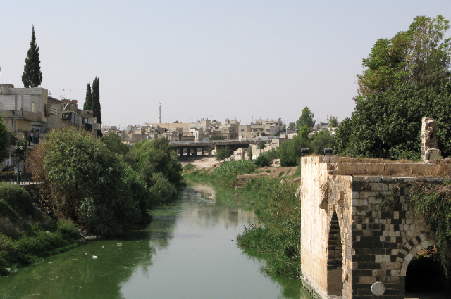
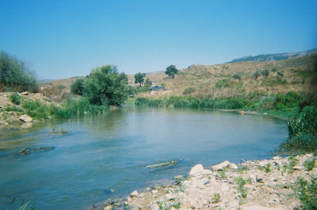
The Orontes River, also known as the Asi River, is a significant watercourse in the Middle East, flowing through Lebanon, Syria, and Turkey, and is crucial in the geopolitics of water resources in the region. Spanning approximately 571 kilometres, the Orontes originates in the Bekaa Valley in Lebanon, flows through Syria, and ultimately discharges into the Mediterranean Sea near Samandağ in Turkey. The river's basin covers an area of roughly 22,300 square kilometres and supports a diverse range of climates and ecosystems, from the Mediterranean climate of the Bekaa Valley and Homs Plain to the temperate climate of the Amik Plain in Turkey. Historically, the geopolitical dynamics of the Orontes River have been shaped by the colonial legacies of the early 20th century when French Mandate borders between Lebanon and Syria failed to consider the river's hydrological basin adequately. This oversight set the stage for future disputes, as national priorities evolved toward economic development and water resource maximization. Lebanon, where the Orontes originate, utilizes the river primarily for agricultural irrigation in the Bekaa Valley, supporting around 1.2 million people who cultivate crops such as wheat, barley, and vegetables. Despite this, Lebanon's water infrastructure on the Orontes remains underdeveloped compared to its neighbors, limiting its ability to harness the river's full potential.
In Syria, which holds the largest share of the Orontes basin at approximately 12,600 square kilometres, around 7 million people depend on the river, particularly in cities like Homs and Hama, where it is crucial for municipal water supply, industrial use, and agricultural irrigation. Syria has constructed significant dams and reservoirs, including the Qattinah Dam with a storage capacity of 200 million cubic meters and the Rastan Dam holding 225 million cubic meters, enabling the country to regulate water flow, generate hydroelectric power, and support large-scale irrigation. However, Syria's extensive utilization of the river has often led to disputes with Lebanon and Turkey, especially during drought periods when water scarcity becomes more acute. Downstream, Turkey controls the lower section of the Orontes, where the river irrigates the fertile Amik Plain, benefiting about 2 million people. The Reyhanlı Dam, with a capacity of 90 million cubic meters, was completed in 2014 and has enhanced irrigation capacity, enabling farmers to cultivate crops more efficiently and reliably. A notable example of bilateral agreements around this region is the 1994 Syrian-Lebanese accord, which sought to allocate water usage between the two countries, granting Lebanon 80 million cubic meters of water annually while the remainder went to Syria. However, the implementation of this agreement has faced challenges due to fluctuating water availability and political tensions. In addition, the establishment of joint water committees and the adoption of integrated water resource management (IWRM) approaches have been proposed to address these challenges.
Litani River
The Litani River, entirely located within Lebanon, is one of the longest rivers in the country, spanning approximately 170 kilometres. Originating in the fertile Bekaa Valley, the river flows southward and then westward before emptying into the Mediterranean Sea near Tyre. The Litani River basin covers an area of about 2,175 square kilometres and is crucial for Lebanon's agriculture, domestic water supply, and hydroelectric power generation. The Litani River Authority, established in 1954, manages the river's resources, including the Qaraoun Dam, which has a storage capacity of 220 million cubic meters and generates around 190 megawatts of electricity annually. The river supports approximately 35% of Lebanon's agricultural production, irrigating crops such as wheat, potatoes, and citrus fruits. However, the Litani has faced significant pollution issues due to untreated industrial waste, agricultural runoff, and sewage, posing risks to public health and reducing water quality for downstream users.
Yarmouk River
The Yarmouk River is a major tributary of the Jordan River, flowing through Jordan, Syria, and Israel. It originates in the Hauran Plateau in Syria and travels southwest, forming the border between Jordan and Israel before joining the Jordan River. The Yarmouk River is approximately 70 kilometres long and its basin covers an area of about 7,000 square kilometres. The river is vital for irrigation, domestic water supply, and hydropower generation in the region. The Al-Wehda Dam, completed in 2006 on the Jordanian-Syrian border, has a storage capacity of 110 million cubic meters and is intended to provide water for irrigation and drinking purposes, as well as generate hydroelectric power. However, water sharing between the riparian countries has been contentious, with disputes over water allocation and usage rights. The Yarmouk River's flow has been significantly reduced in recent years due to upstream diversion and over-extraction, impacting the availability of water for agricultural and domestic use in downstream areas.
Barada River

The Barada River, flowing through Syria, is an essential water source for the city of Damascus and its surrounding region. Originating from the Anti-Lebanon Mountains, the Barada travels approximately 84 kilometres before disappearing into the desert east of Damascus. The river's basin covers an area of about 2,300 square kilometres and supports a population of over 2 million people. The Barada is crucial for Damascus' water supply, agricultural irrigation, and industrial use. The Fijeh Spring, one of the river's major tributaries, is a primary source of drinking water for Damascus. However, the Barada River has been heavily affected by pollution from industrial discharges, untreated sewage, and agricultural runoff, leading to deteriorating water quality and health risks for the local population. Additionally, over-extraction and climate change have reduced the river's flow, exacerbating water scarcity in the region.
Khabur River
The Khabur River, a tributary of the Euphrates, flows through Turkey and Syria. It originates in southeastern Turkey and travels approximately 486 kilometres southward into Syria, where it merges with the Euphrates near the city of Deir ez-Zor. The Khabur River basin covers an area of about 36,000 square kilometres and is crucial for agricultural irrigation in both countries. In Syria, the Khabur Valley is one of the most fertile regions, supporting the cultivation of crops such as wheat, cotton, and barley. However, extensive dam construction and water diversion projects in Turkey have significantly reduced the river's flow, impacting agricultural productivity and water availability in downstream areas of Syria. The river's flow has been reduced by over 60% in some areas due to upstream water usage, leading to decreased water availability for irrigation and drinking purposes in Syria. The Al-Khabur River Basin Project, aimed at improving water management and agricultural practices, has been implemented to address these issues, but challenges remain.
Karun River
The Karun River, located in Iran, is one of the country's most important rivers, flowing for about 950 kilometres from the Zagros Mountains to the Shatt al-Arab River in Iraq. It is the only navigable river in Iran and is crucial for irrigation, water supply, and hydroelectric power generation. The Karun River basin covers an area of approximately 65,230 square kilometres and supports a population of over 7 million people. The river has faced challenges such as pollution and reduced flow due to dam construction and water diversion projects.
Great Zab River
The Great Zab River, also known as the Upper Zab, is a significant tributary of the Tigris River, flowing through Turkey and Iraq. It originates in the Taurus Mountains in southeastern Turkey and travels approximately 400 kilometres before joining the Tigris near the city of Mosul in Iraq. The Great Zab River basin covers an area of about 26,000 square kilometres and is vital for agricultural irrigation, drinking water supply, and hydropower generation in the region. The river supports a population of over 5 million people, providing water for the cultivation of crops such as wheat, barley, and vegetables. In Iraq, the Great Zab is a crucial source of water for the Nineveh and Erbil governorates, supporting both urban and rural communities. However, dam construction and water diversion projects in Turkey have raised concerns about reduced water flow and its impact on downstream areas in Iraq. The river's flow has been reduced by approximately 40% due to upstream water usage, impacting agricultural activities and water availability in downstream areas. The construction of the Bekhme Dam in Iraq, with a storage capacity of 17 billion cubic meters, is intended to improve water management and provide hydropower, but it has also raised concerns about its impact on local communities and ecosystems.
Diyala River

#/media/File:PikiWiki_Israel_56054_electricity_plant_naharaim.jpg)
.jpg)
#/media/File:Khabur,SheikhHamad.jpg)
The Diyala River, another important tributary of the Tigris River, flows through Iran and Iraq. It originates in the Zagros Mountains in western Iran and travels approximately 445 kilometres southwest into Iraq, where it joins the Tigris near Baghdad. The Diyala River basin covers an area of about 32,600 square kilometres and supports a population of over 4 million people. The river is crucial for agricultural irrigation, drinking water supply, and hydropower generation in the region. The Darbandikhan Dam in Iraq, with a storage capacity of 3 billion cubic meters, provides water for irrigation and hydroelectric power, generating around 249 megawatts of electricity annually. The Diyala River supports the cultivation of crops such as rice, wheat, and dates, which are vital for local food security and economic stability. However, water sharing between Iran and Iraq has been a source of tension, with disputes over upstream water diversion and dam construction impacting downstream flow and availability. The river's flow has been reduced by approximately 30% due to upstream water usage, impacting agricultural activities and water availability in downstream areas. The construction of the Hemrin Dam in Iraq, with a storage capacity of 2 billion cubic meters, is intended to improve water management and provide hydropower.
Wars
Wars in the Middle East have caused severe damage to the region's water bodies, exacerbating existing water scarcity issues and posing significant challenges for water management and conservation. The Iran-Iraq War, which lasted from 1980 to 1988, resulted in extensive damage to water infrastructure, including dams, canals, and irrigation systems. The conflict also led to the deliberate targeting of water facilities, such as the destruction of the Dez Dam in Iran, which caused widespread flooding and destruction.
The Gulf War, particularly the 1991 oil spill in the Persian Gulf, had devastating effects on marine life and coastal ecosystems. The deliberate release of oil into the Gulf by Iraqi forces resulted in an estimated 1.5 million barrels of oil being spilt, causing extensive damage to coral reefs, mangrove forests, and fish populations. The spill also contaminated drinking water sources and affected the livelihoods of coastal communities, highlighting the environmental impact of war in the region.
The ongoing conflicts in Syria and Yemen have further compounded water-related challenges. In Syria, the civil war has led to the destruction of water infrastructure, including pumping stations and treatment plants. This has resulted in water shortages in cities such as Aleppo and Damascus, affecting millions of people. In Yemen, the conflict has damaged water distribution networks and infrastructure, leading to a severe shortage of clean water and a widespread cholera outbreak.
Conclusion
In conclusion, water scarcity in the Middle East and North Africa (MENA) is a multifaceted issue deeply intertwined with the region's history, geography, and geopolitics. The arid and semi-arid climate, coupled with burgeoning populations and competing interests, has placed immense pressure on the limited freshwater resources in the region. The management of these resources is further complicated by historical rivalries, contemporary disputes, and strategic considerations among nations.