Geospatial science has quickly evolved from a technical function in an indispensable spine for disaster control and early warning systems worldwide. The center of this revolution has a spontaneous integration of the geographical information system (GIS), remote measurement and other satellite -based technologies, which combine the world’s spatial data together in lifetime equipment for local communities for all natural and man -made threats.
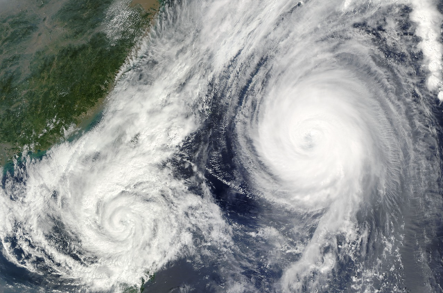
The actual appeal to geophysics in disaster control lies in its multidimensional power to collect, analyze and distribute geographical data in real time. This technical arc begins long before the disaster strike. For example, in India, the India Meteorological Department runs a large-scale multi-time spatial dataset used to monitor possible cyclone activity in Bay of Bengal, Doppler runs a sophisticated network of weather radar, geostationary satellites and on-gold sensors. By feeding this flow of data to GIS -platforms, predicts the first warning models the hurricane path, intensity and potential landfalls with increasing accuracy, sometimes provide up to 72 hours of advance information that can distinguish between life and death.
Such future that abilities are not just about knowing where a storm will hit, but is in the process of understanding the vulnerability deeply. Modern GIS technologies enable layered mapping, combining dangerous information-like floods or earthquakes with risk-regional, socio-economic and infrastructural data sets. This provides multidimensional risk assessments that identify high -risk areas, identify sensitive population (such as elderly, children or disabled) and prioritize emergency plans. A clear example lies in the reaction of Hurricane Katrina in 2005 in the United States. GIS was used to map massive flood exposure, infrastructure damage and withdrawal barriers, where considerable insights into resources, relief and rescue operations should be provided.
Remote measurement, through satellite images or drone, brings another technical edge, especially during and after disasters. In real -time high -resolution images from satellites such as Sentinel or Landsat allow officials to track the cloud cover to the cyclone, track riverine floods or monitor the spread of forest fires. In 2019, Cyclone Fani Odisha, India, Indian Space Research Organization (ISRO) met its satellite funds to provide damage assessment maps in hours, leading the most affected areas to rapid rescue teams and facilitates rapid restoration of transport and power infrastructure.
The first warning Is still one of the crown’s performance with geophysical science. The Indian tsunami early warning center in Hyderabad stands as a world -class example. Here, geophysical technology integrates seismic data, Deep-Esophagus Boys, GNSS status and remote measurement to issue real-time tsunami alerts to the authorities and the public. During the Sulawesi and Tsunami earthquake in Indonesia during 2018, it made it possible for geospatial data local and international teams to track upcoming waves, model their approximate impact and warn the coastal population, even in areas of limited connection.
Beyond the immediate response, geophysics changes rehabilitation and recovery. Damage evaluation when using GIS involves laid over before and subsequent disaster images to determine the amount of buildings, roads, crop areas and natural covers. This information leads not only compensation, but also “strategic plan to build better construction” – ensures that the new infrastructure is outside the danger areas and adapted to future flexibility. For example, after Japan’s earthquake and tsunami in 2011, mapping of Big Bakke -steel formed the design of new cities with high coastal flood barriers and safe, safe, safe.
Technological progress promotes cooperation. Following large disasters, cloud-based geospatial platforms allow many agencies-local authorities, international non-governmental organizations, auxiliary operators to work on the same map, to share live updates on land status, relief supply and network connection. Such platforms were crucial during 2023 Turkish-Syrian earthquakes, where real-time geospatial dashboard tracked the movement of the building and the movement of thousands of displaced people, making the dynamic allocation of rescue teams.
Maybe the one who makes geophysics so transformative has the ability to democratic data. Social media opens new channels for geotagging, SMS audience source and lateral mapping of civil reporting and verification. 2021 Under the floods in Western Europe loaded ordinary citizens uploaded geolocated images of waterfalls, then confirmed and mapped by GIS analysts, who provided an updated flood map before traditional field surveys.
Globally, capacity building is an important focus, especially to expand these benefits to development areas that inconsistently are affected by climate risk. For example, India has invested heavily in training for disaster response, planners and technical personnel through national and regional centers, sharing knowledge and technology with Asia-Pacific neighbors and creating a very important pool of skilled geopolitical professionals.
The future of disaster management quickly indicates greater automation and future accuracy. Artificial intelligence and machine learning algorithms are trained to identify the first disaster signatures from satellite data, while the Internet of Things (IoT) Sensor’s network provides continuous, geopolitical streams from water level to active defects in the water levels to the earthquake. As these different data sources originally merge into intelligent systems, the authorities may soon be able to develop, predict and react with fast and more granularity than before.
The link between geophysical science and disaster control now moves deeply as the roots of any society trying to survive and flourish in today’s risky world. Whether assessing the risk of drought in Africa under city, mapping of wild fires in California, or orchestrating earthquake reactions with multiple agencies in Nepal, this science is about the place of saving life, saving life and paving the way to more flexible communities.
References –
