
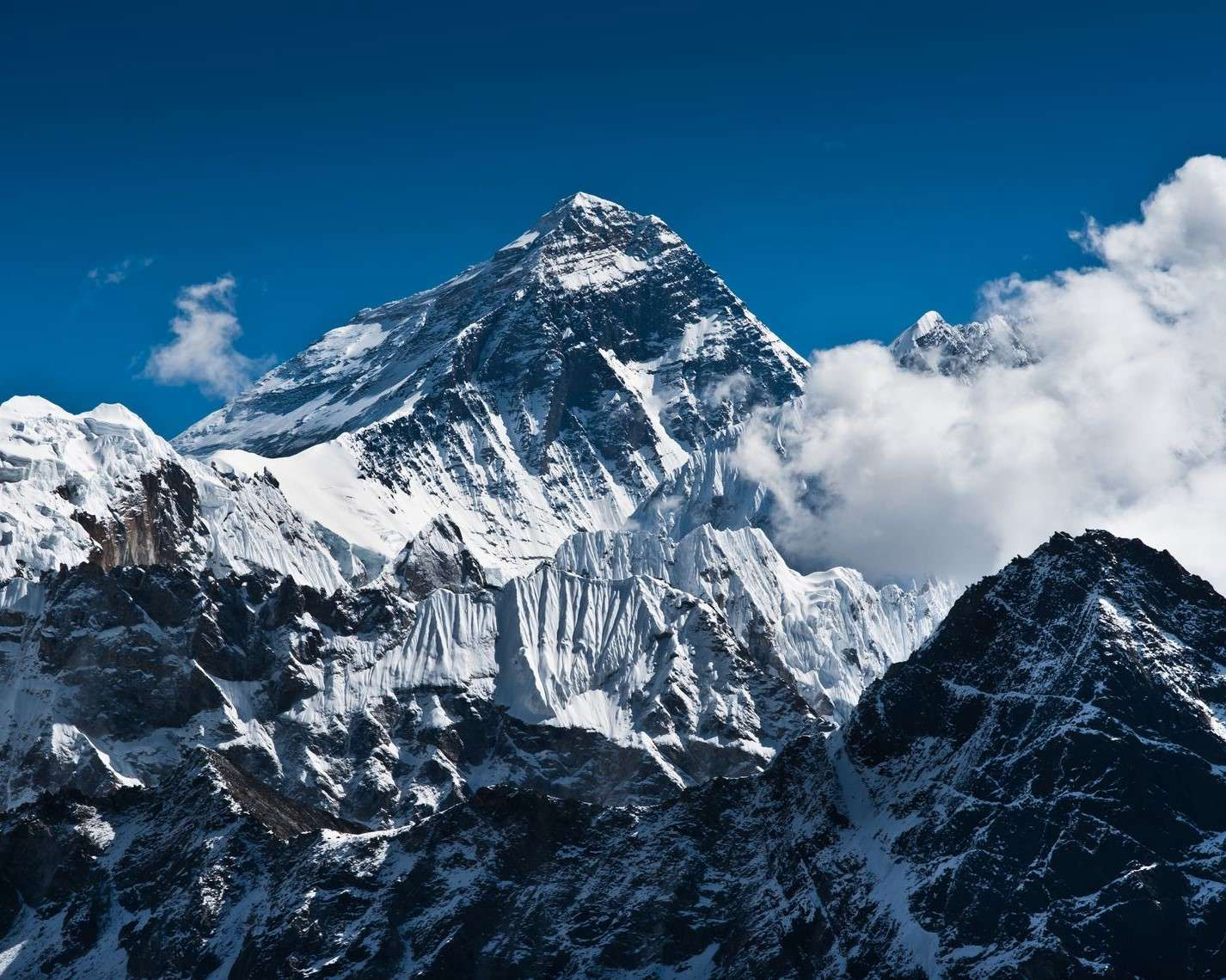
The world's highest mountain is Mount Everest. And recently the entire world was amazed when its height increased by 0.86 meters from previously calculated data. Mount Everest stands on the borders between China and Nepal and researchers and mountaineers climb it from both sides. Nepal and China, both the nations jointly announced that the height of Mount Everest has increased, and the new height of Mount Everest is 8,848.86m, which means 29,032 ft. Officials at Nepal's foreign ministry and Department of Survey explained surveyors from both the nations about the climb and the project. The agreement to jointly announce the new measurement of the Mount Everest was made during Chinese President Xi Jinping's visit to the Kathmandu, Nepal in 2019.
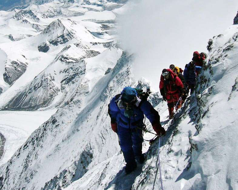
Several researchers from India, America, and China have remeasured the mountain, and they produced ranging between 8844 meters and 8850 meters. Due to the high cost and technical expertise required for this huge project, the government of Nepal had not launched its measurement effort till 2017. The devastating earthquake which occurred in 2015 also caused many changes in the mountains of Nepal. And even after remeasuring was difficult, Nepal had to measure the Mount Everest after the earthquake shook the land. The Survey Department of Nepal reached the top of Mt Everest on 22 May 2019. A team of three people was carrying over 40 kg of equipment, including Ground Penetrating Radar and other types of tools.
The team left their base camp Kathmandu on 11 April 2019 and over a month into the risky trek with bitter cold, the surveyors made it to the mountain on 22 May. On the top, they collected data from the GNSS receiver in an hour and 16 minutes, in -109 Fahrenheit, after which the surveyors descended safely. And even after the researching process at Mount Everest is extremely difficult, there are multiple crucial reasons behind it. Many tectonic activities to the extent that the height of Mt Everest is expected to increase between earthquakes and the decrease in the aftermath of the earthquake, which also happened after the 2015 Nepal earthquake. Due to the satellite technology, the precision of measurement has gotten exceptionally better than before, meaning that new figures on the height of the mountain are likely to be accurate. Moreover, the top of the Mount Everest is covered in ice, and the melting of ice similarly means that the height perhaps has fluctuated several times. Along with all this, measuring the height of Mount Everest has also been a matter of national pride for Nepal. The Survey Department of Nepal has spent US 1.3$ million on the treks, working alongside 6 International firms since 2017. The Survey Department of Nepal utilized both traditional and modern techniques for this massive project.
The traditional method for measuring the Mt Everest is trigonometric and the modern method is the satellite method. Through trigonometry, the height of the Mt Everest was first measured in 1955. In the traditional method, the surveyor measures the angle from horizontal points away from the mountain to make calculations on the heights. However, the problem with the trigonometric method is that light rays bent by the atmosphere can make a mountain look bigger or smaller. The modern satellite methods require surveyors to place a satellite device on top of a mountain, which determines the peak's exact location in a given coordinate system, and a series of calculations from the data thus obtained determine height with a margin of error of a few centimeters. The main challenge with the satellite method is that it measures the height of the geometric model of Earth, instead of the height over sea level. While remeasuring the Mount Everest, both the traditional and modern methods are utilized together, directing to the most precise figures. using the height 8,848m for Mt Everest, and it was determined by India in 1954. After China's height measurements were completed, they pressured Nepal to accept the Chinese height measurements of Mount Everest and consequently, Nepal decided to move for a new measurement to fix the record onetime and for all, the BBC explained. And in 2019, Nepal conducted its measurement of the summit for the first time.
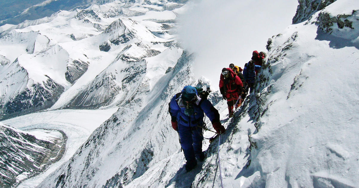
In the 2019s expedition, the Survey Department measured the position and angle of the summit from 12 observation points for trigonometric levelling. A gravimeter, equipment which measures the force of gravity at any given location, was taken to 298 spots. The Ground Penetrating Radar (GPR) measured the thickness of the ice-covered at the top of the mountain. The massive data collection effort included over 80 staff members from the Survey Department. Most of the analysis of the data was conducted in late 2019, but it took place over two years between 2018-2019 with geodetic equipment contributed by multiple nations. The Survey Department decided to announce the findings together because in October 2019, the Chinese President Xi Jinping visited Nepal and an agreement was attained to jointly announce the height of Mount Everest. And due to the COVID-19 tensions with China, there was a delay for an official announcement, and accordingly, the height of Mount Everest was announced in recent months.
____________________________
Reference:
- www.bbc.com
- www.adventureconsultants.co
- www.nationalgeographic.com