
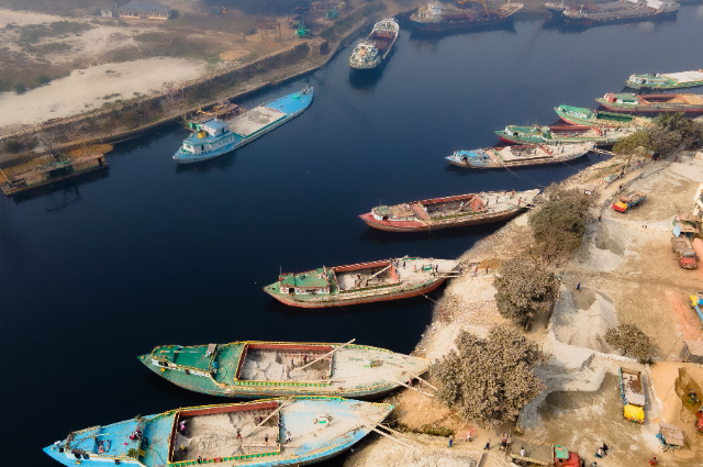
The Saraswati-Sindhu Civilisation was not an isolated urban tradition but developed within wider networks of interaction; however, the relationship between its settlements, merchant communities, trade routes and external regions remains insufficiently integrated. Much of the available evidence, including archaeological remains, material culture, technology, geographical routes and historical references, is studied in isolation, which creates a gap in the understanding of the ways in which goods, knowledge, technologies and communities interacted across the ancient world. This research addresses this gap by developing an integrated study of Harappan/Meluhhan maritime and continental networks and their links to the Arabian Sea, Dilmun, Magan and Mesopotamia and seeks to bring together various forms of evidence to demonstrate the ways and meanings of early interregional interaction.
The research organises Harappan settlements and ports, maritime routes across the Arabian Sea and Gulf, overland connections, material exchange, technological practices and evidence relating to Meluhhan merchant communities. Its methodology focuses primarily on reports, scholarly books, peer-reviewed research papers and scientific studies, supported where relevant by historical records, newspaper/documentary material and interviews with researchers or specialists. Chronology, provenance, material-culture comparison, technological analysis and geographical distribution will be used to distinguish evidence of interaction from similarities arising through independent development. Through this approach, the study aims to provide a more integrated framework for understanding the Saraswati-Sindhu Civilisation's role in early global interactions and to show how ancient networks connected societies through the movement of goods, technologies, knowledge and communities.
The Research Problem
Since their discovery in the 1920s, Mohenjo-daro and Harappa have been recognised as a major Bronze Age urban tradition contemporary with Old Kingdom Egypt and Early Dynastic Mesopotamia. It has long been established that Harappan communities were not restricted to the Indus plains but were integrated, to some degree, with the Arabian Sea's littoral, the Persian Gulf, the Iranian plateau and Central Asia. However, research on this subject has tended to be specialised: archaeologists working on Gujarat's coastal sites, Assyriologists reading cuneiform references to Meluhha, and material scientists analysing bead provenance rarely deal with each other's evidence in a single, integrated argument. This creates a particular challenge to any serious study of the subject: grand assertions about "Harappan maritime trade" or "Meluhhan colonies" in Mesopotamia are frequently repeated in general and popular discourse without specifying exactly which evidence supports which assertion, and with what level of confidence.
This paper does not take any of the following for granted at the outset: that every Harappan coastal site was a functioning port; that all maritime interaction with the Gulf and Mesopotamia was direct rather than mediated through intermediary regions; that the Mesopotamian toponym Meluhha refers unambiguously and exclusively to the entire Harappan cultural zone; that Meluhhan traders in Mesopotamia formed a single, homogeneous community; that a shared artefact type is automatic proof of trade; or that the term Saraswati-Sindhu Civilisation represents an uncontested consensus label. All of these issues are taken as questions the data must answer, not presuppositions.
Research Gap
The particular gap that this paper seeks to fill is the lack, in much of the general writing on the subject, of a clear distinction between (a) what is archaeologically or textually attested, (b) what can be considered a well-founded inference from attested data, (c) what is a plausible but unproven interpretation, and (d) what is genuinely disputed by specialists. Popular, and even some academic, writers often jump from "a Harappan seal was found in Mesopotamia" to "there was a Harappan merchant colony in Mesopotamia" without detailing the inferential steps (or the alternative theories of imitation, intermediary redistribution, gift exchange) that specialists such as Kenoyer and Possehl themselves have presented.
Central Research Question and Subsidiary Questions
Central question: How do archaeological, material, technological, geographical and textual evidence collectively illustrate the maritime and overland networks linking the Harappan world with the Arabian Sea, Dilmun, Magan and Mesopotamia, and what do these sources enable us to conclude with certainty, and what must remain tentative?
Subsidiary questions:
- Which Harappan coastal settlements can be shown, on the available evidence, to have functioned as ports rather than as coastal, riverine or craft-production settlements of another kind?
- What can be reconstructed of maritime routes across the Arabian Sea and the Persian Gulf, and how much of this reconstruction is model rather than fact?
- What overland corridors connected the Harappan world to Baluchistan, the Iranian plateau, Afghanistan and Central Asia, and what did they carry?
- What is the textual and archaeological status of the term Meluhha, and on what basis is it identified, wholly or partly, with the Harappan world?
- What kinds of evidence would be needed to move from "imported goods" to "resident foreign merchants" in Mesopotamia, and does the available evidence meet that bar?
- What archaeological and textual roles did Dilmun and Magan play as intermediary regions, and how does their involvement complicate any simple bilateral model of Harappan-Mesopotamian trade?
- Where do specialists in this field currently disagree, and what does each side's position rest on?
Objectives
The paper has several aims: (i) to create a defensible chronological and terminological framework for approaching Harappan interregional contact; (ii) to examine the archaeological evidence for candidate Harappan ports and coastal settlements; (iii) to reconstruct, to the extent the evidence allows, the Arabian Sea and Gulf seaway and the main overland passages; (iv) to view Meluhha as a research problem, not as a fixed identification; (v) to evaluate the evidence for Meluhhan merchant communities in Mesopotamia in terms of a graduated scale ranging from imported goods to migrant enclaves; (vi) to examine Dilmun and Magan as intermediary nodes; and (vii) to integrate the resultant evidence into a unified, appropriately qualified account of the nature of Harappan interregional interaction.
Scope and Limitations
This paper is a critical synthesis based upon published literature, rather than a report of new fieldwork, excavation or laboratory analysis. It has not been possible within the scope of this exercise to consult every excavation monograph or cuneiform edition in the original; where a claim is based upon a secondary or journalistic account of a primary study, this is explicitly stated, and the reader is advised to consult the underlying publication when citing the claim in a more formal setting. No interviews were conducted for this paper; the methodology described in the original project abstract as potentially including interviews with researchers is, in this version, restricted to published documentary and archaeological scholarship.
Terminology, Periodisation and Chronology
Naming the Civilisation
The civilisation under discussion is most commonly known as the "Indus Civilisation" or "Harappan Civilisation" in international scholarship, after the Indus River system and the type-site of Harappa, respectively. The term "Saraswati-Sindhu Civilisation" used in the title of this paper reflects an alternative naming tradition, currently popular in some Indian scholarly and popular writing, which highlights the large number of Harappan sites located along the now largely dry channel identified by some researchers with the Vedic Saraswati river (often correlated with the Ghaggar-Hakra system) rather than the Indus alone.
This identification, and the question of how far the Ghaggar-Hakra system should be equated with the river described in the Rigveda, is itself a topic of debate amongst archaeologists, geologists and Vedic philologists, and will not be treated as settled here. The present paper uses "Saraswati-Sindhu" in the title, in keeping with the project brief, but uses "Harappan" as the working analytical term throughout the body of the discussion, since this is the term under which the great majority of the archaeological and archaeometric literature cited here was published, and the use of this term here should not be read as taking a position in the debate over the names.
Periodisation
The Harappan cultural sequence is conventionally divided up into an Early Harappan (Regionalisation) phase, a Mature Harappan (Integration) phase of major urbanism (commonly dated to approximately 2600-1900 BCE) and a Late Harappan (Localisation) phase of regional de-urbanisation. The evidence discussed in this paper belongs predominantly to the Mature Harappan period and its Mesopotamian contemporaries, principally the Early Dynastic III, Akkadian (from Sargon of Akkad, c. 2334-2154 BCE by conventional Middle Chronology) and Ur III periods. Where a source gives a specific date, the date is given as stated in the source, and where dating is typological or relative rather than absolute, this is noted.
Approx. Period | Harappan Phase | Mesopotamia / Gulf | Nature of Contact (as reported) |
c. 3200-2600 BCE | Early Harappan | Proto-Elamite / Jemdet Nasr | Chiefly overland, via Iran; Proto-Elamite intermediaries reported |
c. 2600-2450 BCE | Mature Harappan (early) | Early Dynastic III | Earliest carnelian beads of Indus manufacture at Ur reported; direct maritime contact proposed for this period |
c. 2334-2154 BCE | Mature Harappan (peak) | Akkadian Empire (Sargon and successors) | Sargon's inscription on ships of Meluhha, Magan and Dilmun docking at Akkad; Manishtusu/Naram-Sin campaigns toward Magan reported |
c. 2250-2000 BCE | Mature Harappan (late) | Ur III; decline of Magan, rise of Dilmun | Gulf trade increasingly mediated through Dilmun (Bahrain), per Laursen (2009) |
c. 2000-1900 BCE onward | Late Harappan / de-urbanisation | Isin-Larsa / Old Babylonian | Direct textual references to Meluhha become rarer; Bahrain (Dilmun) reported as sole intermediary port for both sides |
Table 1. Chronological correlations of Harappan age with Mesopotamian and Gulf periods, derived from the sources discussed in this paper. Dates are approximate and in line with conventional Middle Chronology, though some are typological rather than radiometric.
Methodology and Source Hierarchy
This paper is based on a hierarchy of sources, giving most weight to primary archaeological reports and scientific provenance studies, then primary Mesopotamian textual evidence, followed by peer-reviewed scholarly interpretation, official institutional material, high-quality scientific reporting, and finally general news or encyclopaedic sources, which are used only for orientation and explicitly noted wherever they are the sole basis for a specific claim. Bibliographic information for all cited works is provided, where possible, in the References section; where a claim could be traced to secondary or journalistic reporting of an underlying study rather than the study itself, this is specified in the text so that the claim is not made with greater certainty than the sourcing warrants.
In line with this hierarchy, each substantive claim about interaction in this paper is, where possible, assigned to one of five grades of confidence: directly attested by archaeological or textual evidence; a strongly supported inference; a plausible but unproven interpretation; a contested interpretation on which specialists actively disagree; or speculation that the evidence currently does not support. This grading is explicitly indicated in Section 12.
Harappan Coastal Settlements and the Problem of "Ports"
Lothal
Lothal, in the Bhal region of Gujarat near the Gulf of Khambhat, is the most extensively discussed candidate for a Harappan port. Excavations by the Archaeological Survey of India between 1955 and 1962 under S. R. Rao uncovered a large baked-brick, trapezoidal basin (approximately 222 by 37 metres and up to 4 metres deep) together with inlet and outlet channels and an adjacent warehouse, which Rao interpreted as a tidal dockyard connected to a former course of the Sabarmati River. This interpretation has been contested for decades: sceptical archaeologists including Gregory Possehl have questioned the scale of maritime activity suggested by the structure, arguing that the lack of substantial shipbuilding remains implied a reliance on overland trade, while others (cited in the secondary literature as Shah, Leshnik and Ratnagar) have argued that the basin was an irrigation or water-storage tank rather than a tidal dock, partly because the present-day coastline lies some 10-20 kilometres from the site. More recently, however, supporting evidence has been reported for the maritime interpretation: the National Institute of Oceanography, Goa, has reported marine microfossils (foraminifera) along with salt and gypsum crystals within the structure, consistent with former inundation by seawater, and a 2024 palaeolandscape reconstruction led by the Indian Institute of Technology, Gandhinagar, using satellite imagery, digital elevation models and multi-sensor data, has been reported as reconstructing a former tidal channel connecting the site to the Gulf of Khambhat. This latter piece of evidence is known to me in consequence of science-journalism coverage rather than direct consultation of the underlying journal article, and its precise claims should be verified against the article in question before being cited without qualification.
On balance, the convergence of the structural evidence (smooth vertical walls, inlet/outlet channels, an adjoining warehouse), the recovered material culture (a Persian Gulf-type circular seal, Persian Gulf and Mesopotamian-style pottery, and imported raw materials such as carnelian, steatite, copper and shell worked at the site) and the more recent palaeo-environmental evidence lends weight to the maritime interpretation of Lothal, while the scale and regularity of its long-distance shipping remains a genuinely open question rather than one that can be settled by the site alone.
Dholavira and the Rann of Kachchh
Dholavira, on Khadir island in the Rann of Kachchh, is one of the largest excavated Harappan cities (roughly 47 hectares) and has recently become a UNESCO World Heritage Site; it features highly sophisticated water harvesting and storage engineering, and was located on a navigable channel, by Harappan standards, to the Gulf of Kachchh, a study linking the decline of the city to the loss of a Himalayan snow-fed river in the area having been reported by a joint IIT Kharagpur-ASI-Deccan College-Physical Research Laboratory team. Dholavira, it must be said, is best characterised, on present evidence, as being more akin to a great fortified urban and riverine/coastal trading centre with access to maritime routes, rather than as a dedicated port structure like Lothal, the precise harbour facilities (if any) for which have not been established with the same specificity as the Lothal basin.
Sutkagan Dor and the Makran Coast
Sutkagan Dor, the westernmost known Harappan site, is located on the Makran coast of Balochistan near the Dasht River, close to the modern Iran/Pakistan border. The site is characterized by fortified stone walls and gateways, and has traditionally been interpreted as a westernmost Harappan trading outpost linking maritime communications from the Persian Gulf and Arabian Sea to the interior; it should, however, be noted that some scholars (reported by Rawat, drawing on earlier work including that of Possehl) have argued that Sutkagan Dor, along with Sotka Koh and Balakot, was in fact sited some kilometres inland along south-flowing watercourses rather than directly on the coast, as a node on a transhipment route from overland to coastal rather than a maritime harbour per se. This caution is a useful corrective to older accounts that assumed every Harappan site within the coastal zone to be necessarily an operating port.
Distinguishing Site Types
Taken together, the evidence from Lothal, Dholavira, Sutkagan Dor and affiliated sites such as Balakot, Kuntasi and Nageshwar provide a firm basis for distinguishing between 'port', 'coastal settlement', 'riverine settlement' and 'craft-production centre' as separate and non-interchangeable categories. Lothal is the best candidate for a dedicated dockyard function; Dholavira combines major urbanism with probable maritime access rather than a dedicated harbour structure; and several Makran and Kachchh sites appear, based on this evidence, to have combined craft production (bead-making, shell-working) with a transhipment role between inland and coastal networks rather than serving as ports in their own right.
Reconstructing the Arabian Sea and Gulf Maritime Network
Direct physical evidence of Harappan seagoing vessels (hulls, shipwrecks) is lacking; reconstruction is based on indirect evidence such as the depiction of boats on seals and terracotta models, the Mesopotamian textual reference to "Magan boats" (taken by some scholars to refer to vessels associated with the Gulf and Indus trading zone), harbours and warehouses at candidate ports, marine shell and fish-bone assemblages, and the distribution of demonstrably Indus-made or Indus-style objects along the Makran coast, the Omani peninsula, Bahrain and southern Mesopotamia. These data indicate that most specialists agree that coastal, cabotage-style navigation between the Makran and Gulf coastlines, supplemented by open water crossings in places, is a plausible model; however, the exact sailing routes, the extent to which monsoon winds were harnessed, and the rate of voyages cannot be reconstructed precisely based on this evidence and should be presented (as this paper is doing) as reasoned models rather than hard facts.
Scholarly opinion is divided over whether Harappan vessels themselves regularly reached Mesopotamian ports, or whether most exchange from the mid-third millennium BCE onwards was facilitated through intermediary zones. Asko Parpola has suggested that around 2400 BCE Harappans sailed directly to Mesopotamia, but that the Gulf polity of Dilmun became the dominant mediator of this sea trade, with this pattern apparently intensified after the fall of the Ur III state, when, in the early second millennium BCE, both Harappan and Mesopotamian vessels are said to have sailed no further than Bahrain, which acted as a joint entrepôt. Richard Meadow has similarly pointed out that while there is pretty good archaeological evidence for Harappan maritime relations with Arabia, and some Mesopotamian textual and iconographic awareness of the Harappan world, this does not prove that most or all of this exchange was conducted by Harappan-crewed ships making the full journey to southern Mesopotamia.
Overland and Continental Networks
A purely maritime account of Harappan interregional contact would be incomplete. The Harappan colony at Shortughai, on the Amu Darya (Oxus) river in northern Afghanistan, excavated by a French archaeological mission, is widely interpreted as having been positioned to control access to the lapis lazuli deposits of nearby Badakhshan (notably the Sar-i Sang mines), the only significant source of this stone in the ancient world. Evidence recovered at Shortughai reportedly includes raw lapis lazuli, production waste and finished beads, consistent with on-site processing by artisans working in a broadly Harappan technological tradition, alongside evidence of local, non-Harappan cultural practices at the site.
From Badakhshan, lapis lazuli moved along corridors associated with the upper Indus, Kabul and Helmand river systems into the Harappan cultural zone, and from there, via both overland Iranian routes and maritime Gulf routes, into Mesopotamia and ultimately Egypt; several specialists (drawing on Moorey's work on Bronze Age lapis lazuli) have suggested that both overland and maritime legs may have been used at different points in the network, and that a single, exclusive route should not be assumed. Additional evidence for overland Harappan connections toward the Iranian plateau includes Indus-style material at sites such as Konar Sandal South and Jiroft in southeastern Iran, where a white marble seal with Indus-style iconography has been reported, suggesting the presence or influence of Indus artisans or traders at that node, though the strength of this evidence for a permanent Harappan presence there, as opposed to episodic contact or exchange through intermediaries, remains to be more fully established.
On the whole, the overland evidence points to a network of resource-specific outposts and exchange corridors, most clearly demonstrated for lapis lazuli, that operated in parallel with, rather than as a substitute for, maritime routes into the Gulf and Mesopotamia. Early Harappan-period contact with Mesopotamia and Elam is, on the available evidence, more plausibly reconstructed as principally overland via Baluchistan and southwestern Iran, with a Proto-Elamite intermediary role, while direct or Gulf-mediated maritime contact becomes archaeologically more prominent in the Mature Harappan period.
Meluhha: A Textual and Archaeological Problem
The Mesopotamian References
The toponym Meluhha (also transliterated as Meluḫḫa) is frequently mentioned in Mesopotamian cuneiform texts dating to the Sargonic period and later. In a famous inscription, Sargon of Akkad (conventionally dated to c. 2334-2279 BCE) is said to have boasted that he "moored the ships of Meluhha, Magan and Tilmun (Dilmun) at the quay of Akkad," and Sargon's grandson Naram-Sin and his son Manishtusu are both linked to campaigns or building projects involving references to Magan and, by implication, this broader trading region. Gudea of Lagash, who lived in the twenty-second century BCE, is reported to have noted that people from Meluhha brought wood and other materials for the construction of his capital's major temple. Subsequent Assyrian mentions of Meluhha, dating to the first millennium BCE, appear in a significantly different geographic and political context and are generally understood by experts to no longer refer to the same area, demonstrating that the term's application could have changed over the several centuries for which it was in use.
The Identification with the Harappan World
The identification of the earlier, third- and early second-millennium Meluhha with the Harappan cultural zone is based on a convergence of indirect evidence rather than a single clear text: the association of Meluhha in cuneiform texts with commodities independently identified archaeologically as Harappan exports (carnelian, ivory, certain hardwoods, particular marine shell species, and copper), the order in which Meluhha, Magan and Dilmun are quoted (compatible with a rough west-to-east geographical sequence from Mesopotamia through the Gulf), and the existence of an Akkadian cylinder seal belonging to one Shu-ilishu, inscribed (in the standard reading) "Shu-ilishu, interpreter of the Meluhhan language," which is widely interpreted as indicating that Meluhhan speakers were present in Mesopotamia in sufficient numbers, or with sufficient administrative prominence, to require the employment of dedicated interpreters. These indications taken together make the Harappan identification the most strongly supported reading amongst mainstream Assyriological and archaeological specialists, but it should be seen as a strong inference rather than an outright attested equivalence: no cuneiform text directly states that Meluhha and the Harappan civilisation (as archaeologically defined) are the same entity, and the identification relies on combining textual, linguistic and archaeological strands of reasoning.
This paper also observes, without endorsing, that alternative and more speculative decipherments of Indus script materials exist in some non-mainstream literature and are occasionally used to support maximalist claims about Meluhha; such decipherment claims are not taken seriously by the mainstream international community of Indus script specialists (the script itself is still formally undeciphered) and are not used here.
Meluhhan Merchants and Communities: What the Evidence Can and Cannot Establish
This is treated here as the most sensitive interpretive step in the whole subject, and the paper follows a graded scale rather than a single yes/no judgement, moving from the weakest to the strongest claim about the presence of Harappan-associated people in Mesopotamia.
Level 1: Imported Goods
The presence of Harappan or Harappan-style objects in Mesopotamia (seals, carnelian beads, certain marine shell artefacts, cubical stone weights, and monkey figurines in an Indus style) is directly attested archaeologically at sites including Ur and Kish, and does not by itself require the physical presence of Harappan people in Mesopotamia; such goods could equally have travelled through several intermediary hands, particularly via Dilmun.
Level 2: Evidence of Craftspeople or Technology, Not Necessarily Settlers
Geochemical and technological analysis is more diagnostic than typology in this case. Recent laser-ablation ICP-MS sourcing of carnelian beads from Early Dynastic III contexts at Kish, Iraq (Kenoyer and Law), has revealed that the beads are fashioned from carnelian of Indian geological origin, but that some were manufactured using Indus drilling and shaping technology while others exhibit technologies consistent with production by Indus-trained craftspeople working locally in Mesopotamia rather than the importation of finished Indus products. Likewise, strontium isotope analyses comparing material from Harappa and Ur (Kenoyer et al.) have been taken as indications of the transportation of raw material, and potentially of the people with the specialist, multi-year apprenticeship knowledge required to work it, between the two regions. This type of evidence is more robust than that of simple typological similarity since the chaîne opératoire (sequence of manufacturing techniques) required years of specialist training, and cannot be explained by casual imitation, yet still establishes the presence of Indus-trained artisans and their techniques rather than definitive multi-generational settlement.
Level 3: Named Individuals and Interpreters
The Shu-ilishu seal (discussed in Section 7.2) provides textual evidence for at least one named individual acting as an interpreter of the Meluhhan language in Mesopotamia. A different late Sargonic tablet, dated to approximately 2200 BCE and discussed by Parpola, refers to a man described as "the holder of a Meluhha ship"; specialist opinion suggests that this may refer either to a Mesopotamian who owned a ship trading with the Meluhha region, or possibly to a person of Meluhhan (broadly, Indus-region) descent, several generations removed, who had acquired an Akkadian name through intermarriage and acculturation. Neither interpretation can be ruled out on present evidence, and this is a genuine point of uncertainty rather than a set fact.
Level 4: "Meluhha Villages" and Enclaves
Some scholarship, notably associated with Parpola's work on the "Meluhha village," has proposed that groups of people of Harappan origin lived in dedicated settlements or quarters within Mesopotamian urban centres during the later third millennium BCE, drawing on onomastic evidence (a small number of personal names in Mesopotamian records argued to be of Meluhhan or Dravidian derivation), together with the interpreter and ship-holder evidence discussed above. This remains, on the evidence summarised here, a plausible but genuinely contested interpretation: the number of securely identified Meluhhan personal names is small, their linguistic derivation is disputed, and no Mesopotamian text unambiguously describes a bounded, self-identified Meluhhan residential quarter in the way that, for example, foreign merchant colonies are documented in some other periods and regions of the ancient Near East.
Summary Judgement
The cumulative evidence — imported goods, geochemically and technologically demonstrated craft transfer, named interpreters and possible ship-holders, and more speculative onomastic evidence for resident communities — makes it a reasonable and moderately well-supported inference that some individuals of Harappan cultural background lived and worked in Mesopotamian cities for extended periods, in roles connected to trade, craft production and translation. It does not, on the evidence reviewed here, support a claim of large-scale, ethnically bounded "Meluhhan merchant colonies" comparable in documented detail to the merchant colonies known from later periods of Near Eastern history; that stronger claim should be treated as contested rather than established.
Dilmun and Magan as Intermediary Worlds
Dilmun, generally identified by the present consensus of scholarly opinion with Bahrain, Failaka Island and adjacent coast of Eastern Arabia, and Magan, generally identified with the coastal areas of modern-day Oman and the United Arab Emirates, are both frequently named alongside Meluhha in Mesopotamian sources and should be seen as dynamic political entities rather than fixed geographic designations, whose roles in the network were themselves in flux. Archaeological excavations on Bahrain and at Umm an-Nar period sites in the Oman peninsula indicate that Magan provided copper and diorite to Mesopotamia and acted, according to Umm an-Nar research, as both intermediary and supplier/consumer in a largely bipolar sphere of exchange between Mesopotamia and the Indus region, as well as being a political actor in its own right rather than a mere conduit. Laursen's (2009) ceramic analysis of Umm an-Nar pottery recovered from Early Dilmun burial mounds on Bahrain demonstrates a transition dated to roughly 2250-2000 BCE in which the quantity of Magan-derived pottery on Bahrain diminishes just as Dilmun's distinctive mounded-cemetery tradition becomes more compact and pronounced, interpreted as the relative decline in Magan's influence and the concomitant rise in Dilmun's importance as the dominant Gulf intermediary in the very late third and early second millennia BCE.
This fluctuating preponderance of Magan and Dilmun is of wider significance in the present discussion in that it indicates that Harappan-Mesopotamian interaction cannot be conceived of in terms of a simple, static bilateral relationship. Even during those phases when Harappan goods and possibly Harappan-trained craftspeople reached Mesopotamia in significant quantities, the route by which they arrived and the political actor facilitating this differed across the Mature Harappan period, with a general movement (as reconstructed by Parpola and others) from relatively direct maritime contact c.2400 BCE towards increasingly Dilmun-mediated exchange by the early second millennium BCE.
Material Culture as Evidence
Material culture is the most abundant and, when subjected to scientific provenance analysis, often the most reliable class of evidence available for this subject, but it requires careful interpretation.
Carnelian and Etched Beads
Long biconical and 'etched' or bleached carnelian beads are amongst the most distinctive of Harappan exports. Detailed technological and, more recently, geochemical studies (Kenoyer and colleagues) of beads recovered from the Royal Cemetery at Ur and from Kish suggest that the raw carnelian was of Indian geological origin, and that the finished beads represent a mixture of imports from the Indus region and local Mesopotamian manufacture using imported raw material and Indus techniques. Indus-style bleached carnelian beads of this general type have also been reported as far afield as south-eastern Iran, Central Asia, the Gulf, and, in smaller numbers, the eastern Mediterranean (including a reported find at Aegina-Kolonna in Greece), illustrating that their distribution reflects a multi-stage exchange network rather than a single bilateral trade route, and that their presence at any one site cannot automatically be interpreted as evidence of direct Harappan-Mesopotamian contact without further contextual and technological analysis.
Seals
Harappan-style stamp seals with Indus script and iconography (most commonly the "unicorn" motif) have been reported from Mesopotamian sites including Ur, Kish and Susa; rough estimates quoted by secondary literature (Possehl, attributed) put the number of Harappan-related seals found in Mesopotamia at somewhere around two hundred and fifty, though this paper has neither verified the figure quoted independently nor does it claim to confirm it against the primary excavation literature. Seals are valuable evidence of contact and possibly of administrative practice involved in trade, but the presence of a seal at a site is a testament only to the travel of the object concerned; it does not in and of itself indicate whether it was carried by a Harappan trader, a Mesopotamian who had acquired it through intermediary trade, or a descendant of an earlier Harappan migrant.
Shell, Metals and Other Materials
Marine shell species restricted to Indus and adjoining Omani waters (Turbinella pyrum and Lambis truncata sebae) have been identified in worked Mesopotamian artefacts, providing relatively strong evidence for the movement of specific raw materials, and by extension plausibly of the people who worked them, between the Indus region, Oman and Mesopotamian cities. Copper is repeatedly associated with Magan in Mesopotamian texts and appears likely to have moved via the Oman peninsula rather than directly from the Indus region, illustrating again the role of Gulf intermediaries even where the ultimate cultural association of a technique or product is Harappan.
Technological Exchange
Where a technological practice, such as the specific drilling and heat-treatment sequence used for long carnelian beads, is demonstrably shared between the Indus region and Mesopotamian findspots, and where this sequence required extended, specialised apprenticeship rather than casual observation, technology transfer carried by trained individuals is a better-supported explanation than either coincidental parallel development or the movement of finished objects alone. By contrast, broader similarities in weights, measures or ceramic forms across the wider Gulf-Indus-Mesopotamia zone should be treated more cautiously, since standardisation can also arise from shared administrative pressures, from imitation of prestige goods without the underlying skill transfer, or from convergent responses to similar raw materials, and the evidence reviewed here does not allow every such similarity to be attributed to direct transmission.
Evidence-Confidence Assessment
Following the source-hierarchy and graded-confidence approach set out in Section 3, the major claims discussed in this paper can be summarised as follows.
Claim | Evidence Type | Confidence Level |
Harappan seals, pottery and beads reached Mesopotamian cities (Ur, Kish, Susa) | Archaeological / material | High confidence |
Some Ur/Kish carnelian beads were made from Indus raw material using Indus techniques, some locally in Mesopotamia. | Geochemical + technological (Kenoyer & Law) | High confidence |
Sargon-era Mesopotamia had textual awareness of Meluhha, Magan and Dilmun as trading partners | Primary cuneiform inscriptions | High confidence |
Meluhha (3rd/early 2nd millennium) refers, wholly or largely, to the Harappan cultural zone | Combined textual + archaeological inference | Strongly supported inference |
Lothal's brick basin functioned as a tidal dockyard | Structural + palaeo-environmental evidence, contested for decades | Moderate-to-strong, still contested by some |
A named individual (Shu-ilishu) served as a Meluhhan-language interpreter in Mesopotamia | Primary cuneiform seal inscription | High confidence (for the fact of the seal); interpretation of implications is inferential |
Permanent, ethnically bounded "Meluhhan merchant colonies" existed in Mesopotamian cities | Onomastic + circumstantial textual evidence | Contested / plausible but unproven |
Shortughai was established specifically to control Badakhshan lapis lazuli supply | Archaeological (site location, production debris) | Strongly supported inference |
Dilmun progressively replaced Magan as the principal Gulf intermediary, c. 2250-2000 BCE | Ceramic seriation (Laursen 2009) | Strongly supported inference |
Harappan ships regularly sailed the full distance to southern Mesopotamian ports throughout the Mature Harappan period. | Indirect / inferred from goods and texts; no surviving vessels | Contested; increasingly doubted for the later part of the period |
Table 2. Evidence-confidence summary for the paper's principal claims.
Critical Discussion
What the Evidence Demonstrates
The evidence reviewed here directly demonstrates sustained material exchange between the Harappan world and Mesopotamia across the mid-to-late third millennium BCE, textual awareness in Mesopotamia of a trading partner or partners referred to as Meluhha, Magan and Dilmun, and the presence in Mesopotamia of at least some individuals with specialised Indus-derived craft knowledge and, in at least one case, language skills.
What the Evidence Suggests but Does Not Prove
The evidence suggests, without conclusively proving, that Meluhha refers predominantly to the Harappan cultural zone; that a modest number of Harappan-origin individuals lived for extended periods in Mesopotamian cities in trade- and craft-related roles; and that overland lapis lazuli routes and maritime Gulf routes operated as complementary, not mutually exclusive, systems.
What Remains Contested
Specialists continue to disagree over the functional interpretation of the Lothal basin, the scale and regularity of direct Harappan seafaring to Mesopotamia as opposed to Dilmun-mediated exchange, whether onomastic evidence supports bounded "Meluhhan villages" or merely occasional resident individuals, and the exact geographic boundaries of Meluhha, Magan and Dilmun across the several centuries in which these names were used, given evidence (from later Assyrian sources) that at least the referent of "Meluhha" may have shifted geographically over time.
Alternative Explanations Considered
Throughout this paper, alternative explanations have been weighed against the preferred interpretation at each step: a shared bead type may reflect trade, intermediary redistribution, or imitation rather than migration; a Mesopotamian textual reference to Meluhha may describe direct trade, Dilmun-mediated trade, or a broad geographical category rather than a precise polity; and a coastal Harappan site may be a genuine port, a seasonal exchange point, a craft centre, or (as at Sutkagan Dor, on some readings) primarily an inland node on a route toward the coast rather than a harbour itself.
Methodological Limitations of This Paper
This paper is a synthesis of published (largely English-language) secondary and tertiary sources supplemented by identifiable primary studies located through systematic search; it has not included direct examination of excavation archives, cuneiform tablets, or laboratory samples, and at least one recent claim (the 2024 Lothal palaeolandscape study) is reported here only via the science-journalism coverage rather than the underlying peer-reviewed article, which should be consulted directly before the claim is used in any more formal academic submission. Readers intending to use this paper for competitive academic purposes are strongly advised to verify every citation against the original publication, as bibliographic details reported here are only as reliable as the secondary sources through which they were obtained.
Towards an Integrated Model
Assembling the threads of evidence, the most well-supported model of Harappan inter-regional interaction that can be inferred from this review is one of a layered and changing system rather than a coherent network. In the Early Harappan period, contact towards Mesopotamia and Elam appears to have been primarily overland (via Baluchistan and south-western Iran) mediated by Proto-Elamite intermediaries. During the early Mature Harappan period, archaeological and textual evidence converges on a phase of more direct maritime contact (plausibly including Harappan vessels reaching Mesopotamian ports) alongside the parallel operation of the Shortughai-centred overland lapis lazuli corridor from Badakhshan. From around the mid-to-late third millennium BCE, the Gulf polities of Magan and then increasingly Dilmun began to take a growing intermediary role, such that by the early second millennium BCE, exchange between the Harappan world and Mesopotamia is best modelled as substantially mediated through Bahrain rather than as direct bilateral shipping. Within this network, some individuals of Harappan cultural background (craftspeople, interpreters, and possibly small resident groups) appear, on a reasonable but not conclusive reading of the evidence, to have lived in Mesopotamian cities for extended periods, carrying with them their specialised technical knowledge (most clearly demonstrated for carnelian bead production) that outlived the simple movement of finished goods.
This paper set out to develop a critical, evidence-graded account of Harappan maritime and overland interregional networks, refusing to assume that every coastal settlement was a port, that all contact was direct, or that Meluhha and its associated merchant communities can be taken as equatable with the Harappan civilisation as a whole. The picture which emerges is one of a truly interconnected but unevenly documented world: strong, multiply-corroborated evidence for sustained material and technological exchange with Mesopotamia and the Gulf; well-supported but still-debated evidence for a changing maritime and intermediary network centred first on direct contact and later on Dilmun; and a textually and archaeologically real, but incompletely resolved problem in the identification of Meluhha and the nature of any resident merchant communities associated with it. The paper's contribution lies not in proposing new archaeological data, but in demonstrating, by the deliberate separation of evidence tiers and confidence levels, how much of the standard narrative about Harappan-Mesopotamian contact rests upon strong evidence, and how much continues to depend on inference which specialists themselves continue to debate. A more complete resolution of the remaining questions will require further scientific provenance studies of the kind pioneered by Kenoyer and colleagues, further excavation and publication from Gulf sites, and continued, cautious re-reading of the Mesopotamian textual corpus.
References:
- Britannica. "Shortughai." Encyclopaedia Britannica online, entry under "India: Other important sites."
- Kenoyer, J. M. (1998). Ancient Cities of the Indus Valley Civilisation. Oxford University Press / American Institute of Pakistan Studies.
- Kenoyer, J. M., & Law, R. W. (2026). Sourcing carnelian beads from the ancient Mesopotamian site of Kish, Iraq, 2450-2200 BCE: Stylistic, technological and geochemical approaches. Archaeometry. https://doi.org/10.1111/arcm.13098
- Kenoyer, J. M., et al. (2013). A new approach to tracking connections between the Indus Valley and Mesopotamia: initial results of strontium isotope analyses from Harappa and Ur. Journal of Archaeological Science (as indexed on ScienceDirect; full citation details to be confirmed against the published article).
- Laursen, S. T. (2009). The decline of Magan and the rise of Dilmun: Umm an-Nar ceramics from the burial mounds of Bahrain, c.2250-2000 BC. Arabian Archaeology and Epigraphy, 20, 134-155. https://doi.org/10.1111/j.1600-0471.2009.00317.x
- Meadow, R., & Parpola, A. (n.d.). Was the trade relationship between the Harappans and the Mesopotamians a direct one? Harappa.com, Q&A section. Retrieved from https://www.harappa.com
- Parpola, A. (1977). The Meluhha Village: Evidence of Acculturation of Harappan Traders in Late Third Millennium Mesopotamia. Journal of the Economic and Social History of the Orient, 20(2). (Cited here via secondary discussion in "By The Quays of Akkad," academia.edu; original article to be verified directly.)
- Possehl, G. L. (2002). The Indus Civilisation: A Contemporary Perspective. AltaMira Press. (General reference for the scholarly scepticism toward the scale of Lothal's maritime role discussed in Section 4.1, reported via secondary commentary in The Print, 2025.)
- Rao, S. R. Archaeological Survey of India excavation reports on Lothal, 1955-1962 (primary excavation reports; consulted here only through secondary academic and journalistic summaries — see Arkeonews, 2024, and Archaeology News Online Magazine, 2024, below).
- Ratnagar, S. (2004). Trading Encounters: From the Euphrates to the Indus in the Bronze Age (rev. ed.). Oxford University Press. (General reference for the sceptical position on Lothal's dockyard scale.)
- Rawat, Y. S. (2015). Gujarat [chapter discussing Harappan Gujarat coastal sites, including Sutkagan Dor, Sotka Koh and Balakot]. In Indian Ocean/Gulf archaeology volume, retrieved from https://www.ancientportsantiques.co.m
- Archaeology News Online Magazine (2024, September). New research confirms the existence of the ancient Harappan dockyard at Lothal, India. https://archaeologymag.com
- Arkeonews (2024, September). New studies confirm that there was indeed a shipyard at Lothal. https://arkeonews.net/
- The Print (2025, March). Lothal was a complex urban centre with maritime connections. It had a dockyard too. https://theprint.in
- Frenez, D. (2023), cited in: An early historic bleach-decorated carnelian bead from Sumhuram (Dhofar, Oman). ScienceDirect (2026). https://www.sciencedirect.com
- Wikipedia contributors. "Lothal." "Sutkagan Dor." "Dholavira." "Indo-Mesopotamian relations." "Indian maritime history." "Umm Al Nar culture." "Economy and trade of pre-Islamic Arabia." "Badakhshan Province." "Lapis lazuli." Wikipedia, The Free Encyclopedia. (Tertiary sources, used for general orientation and cross-checking only; not relied upon as sole authority for any specific claim.)
- Archaeology Wiki (2013, May). Discovering Dilmun. https://www.archaeology.wiki
- Penn Museum, Expedition Magazine. "A Search for Ancient Seaports" and "Shipping and Maritime Trade of the Indus People." https://www.penn.museum/sites/expedition/