
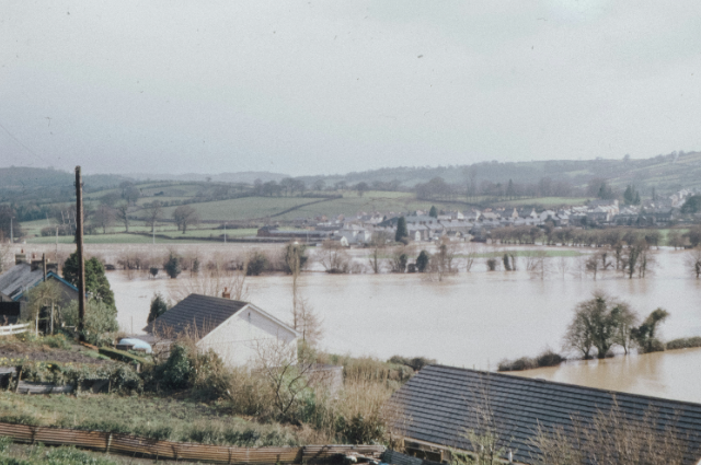
For a farmer, a field is never just a piece of land. It is food, income, inheritance, security, and often the only future a family can imagine. In Assam, however, that future is increasingly being washed away with every monsoon. The 2026 floods have once again exposed the terrible vulnerability of farming communities, but this year’s disaster has carried a different force. Upper Assam’s Sivasagar, Charaideo, Jorhat and Golaghat witnessed devastating flooding after intense rainfall and sudden surges in tributaries linked to the hills of neighbouring Nagaland. By August 9, the flood death toll in Assam had reached 100, according to reports, while thousands of families were still dealing with damaged homes, lost livestock and ruined agricultural land. The most painful question is not simply how much water entered Assam. It is how many times a farmer can lose everything before farming itself becomes impossible.
The story began taking a dangerous turn between July 18 and July 20. Heavy rainfall affected parts of Assam and Nagaland, and enormous quantities of water moved through rivers and tributaries flowing towards Upper Assam. On July 20, reports said the Dikhow had crossed its highest flood level, while other rivers were also flowing above danger levels. Sonari in Charaideo recorded 197.5 mm of rainfall between July 18 and 19, while other parts of the region also recorded heavy rain. The flooding was particularly frightening because many people in Sivasagar and Charaideo were not accustomed to seeing their villages inundated on this scale. In Nepalikhuti, for example, residents described water entering homes with extraordinary speed. In Santak Panchali, residents said the water reached chest level within minutes, forcing families to take shelter in buildings. These were not communities mentally prepared for a conventional seasonal flood. They were watching an apparently ordinary landscape turn into a deadly river.
Then came July 19, the day that changed the lives of thousands. In several villages, the water did not rise slowly enough for families to collect belongings or move livestock. Reports from the ground described people climbing onto rooftops and taking shelter in schools and other elevated buildings. In Nepalikhuti, around 60–65 families reportedly sought refuge in a two-storeyed building, while residents described homes, cattle and possessions being swept away. One resident of Santak Panchali recalled that water entered the village around 1 pm and reached chest level within about twenty minutes. The devastation was especially severe for dairy farmers. Cows and goats were not simply animals; they were household assets and sources of daily income. When floodwater carried them away, families lost both their property and their ability to earn. This is why the image of a farmer staring at a submerged field is so powerful: beneath that water lie seeds, labour, money and months of expectation.
The explanation for the disaster soon became contested. Early statements linked the flooding to a cloudburst in Nagaland. But on July 24, Assam Chief Minister Himanta Biswa Sarma clarified that the IMD had not officially confirmed a cloudburst. The Indian Express also reported that a scientist at the Meteorological Centre in Kohima said Mon had received about 137 mm of rain over eight to nine hours on July 19, rather than the more than 100 mm in a single hour required by the IMD definition of a cloudburst. This distinction matters because reducing the disaster to one extraordinary weather event risks overlooking the deeper weaknesses that allowed the water to become so destructive. Heavy rain may trigger a flood, but the scale of destruction is also determined by what has happened to hills, rivers, wetlands, drainage channels, embankments and floodplains over many years.
That is where the farmer’s story becomes much larger than one monsoon. Assam’s Water Resources Department says 31,500 square kilometres, or 39.58 per cent of the state’s land area, is flood-prone. It also records that about 4.27 lakh hectares have been eroded by rivers since 1950, with an average annual erosion rate of around 8,000 hectares. These figures explain why losing a field in Assam can mean losing it permanently. Floodwater does not always simply arrive, cover the crop, and disappear. It can carry away topsoil, deposit thick layers of silt, alter river channels and eat into farmland from one year to the next. A farmer may rebuild a field after one flood, plant again after another, and then discover that the river has moved closer to the house. The tragedy is not only that agriculture is damaged. It is that the land itself becomes increasingly uncertain.
The 2026 disaster also brought renewed attention to what happens upstream. Scientists and researchers have pointed to deforestation, hill cutting, mining, wetland degradation and unplanned infrastructure as factors that can increase the vulnerability of river systems. The concern is particularly significant because the Dikhow, Disang and other tributaries receive water from catchments extending into the hills. Professor Arup Kumar Sarma of IIT Guwahati has explained that vegetation loss can dramatically increase sediment movement from hill catchments. Sediment eventually settles in river channels, reducing their capacity to carry water. In simple terms, the problem is not only that more water reaches the river; the river can also have less space to carry it. Once that happens, water that might previously have remained inside the channel can spread across farmland and settlements. For a farmer, the scientific language of “sediment yield” and “channel capacity” eventually becomes something painfully simple: water where the crop should be.
By July 21 and July 22, the human consequences were becoming clearer. Farmers were returning to fields that no longer looked like fields. In Gaurisagar, large agricultural areas were submerged, while reports from Sivasagar described extensive crop destruction. The Migration Story reported that around 95 per cent of farmland in Sivasagar had been ruined, according to a local farmer-support organisation. The damage created a second crisis: migration. When agriculture cannot support a family, younger members often leave for cities. One Sivasagar farmer’s son, Mintu Hazarika, was already working as a security guard in Bengaluru and sending part of his earnings home. After the July flood destroyed his family’s paddy cultivation on five acres, his elder brother was considering moving to Bengaluru for work. This is how a flood travels far beyond Assam. Water destroys a field in Sivasagar, and months later the economic consequences can appear in Bengaluru, Chennai, Kochi, Kerala, or elsewhere.
There is another uncomfortable lesson in the 2026 flood: Assam cannot treat every flood as an unavoidable act of nature. The state’s own Water Resources Department acknowledges that flood and erosion remain major problems and lists embankments, drainage improvement, sluices, raised platforms, forecasting and flood zoning among its flood-management measures. Yet the same department notes that long-term measures to mitigate flood and erosion problems have not been adequately implemented, with much of the work historically focused on immediate and short-term protection. That gap matters enormously. An embankment may protect a village for years, but if the riverbed rises, drainage becomes blocked, wetlands disappear, and the surrounding landscape is altered, the same structure may eventually become inadequate. Protection cannot mean simply building another wall. It must mean understanding the entire river basin.
By early August, the waters were receding in several places, but recovery was proving almost as difficult as survival. The Indian Express reported that even after water levels fell, parts of Sivasagar and the Nazira area remained difficult to reach because receding water had left behind layers of sediment. Houses needed cleaning, roads needed restoration, livestock had been lost, and agricultural land needed to be assessed before farmers could even think about planting again. The Assam government also announced financial assistance for affected families, including interim relief and additional assistance for families in Sivasagar and Charaideo. Relief is essential, but compensation cannot replace a lost agricultural season overnight. A farmer does not need only money after a flood. The farmer needs seeds, livestock, tools, clean water, functioning roads, credit, soil restoration, and the confidence that the next crop will not disappear beneath another sudden wall of water.
By August 9–10, the death toll had reached 100, according to reports, even as the number of people currently affected fell as floodwaters receded. The immediate emergency may be easing, but Assam’s larger emergency remains. This year’s flood has shown that danger does not belong only to the Brahmaputra’s main channel. Sudden flooding in tributaries can devastate communities that historically considered themselves relatively safe. It has also shown how quickly an environmental problem becomes a social and economic one. A farmer who loses one harvest may recover. A farmer who loses a field repeatedly may borrow money. A family that loses livestock may sell assets. A young person who sees no future in farming may migrate. Eventually, an entire rural economy begins to weaken.
The most heartbreaking image from Assam is therefore not simply the overflowing river. It is the farmer standing beside a field that took months of labour to prepare, watching the crop disappear under brown water. For someone who has endured one monsoon after another, the question is no longer whether Assam will flood. The question is whether the farmer will still have land worth returning to when the water finally leaves. The answer cannot come from relief alone. Assam needs stronger early-warning systems, better protection of wetlands, scientific river and sediment management, strict regulation of mining and hill cutting, restoration of natural drainage, stronger embankments where appropriate, and—most importantly—long-term planning based on the entire connected river basin. The farmer who loses a field year after year should not be treated as an unfortunate statistic of the monsoon. His loss is a warning. When a river repeatedly takes away a farmer’s harvest, livelihood, and security, the disaster is no longer only about water. It is about whether we have allowed the land to become so fragile that an ordinary monsoon can destroy an extraordinary number of lives.
References
- India Today — “Assam Floods 2026: The rain was ordinary, so why did Upper Assam drown?”
- Mongabay — “Assam floods expose a crisis beyond heavy rain.”
- The Hindu — “A flood of woes in Assam.”
- Down To Earth — “On International Day of the World’s Indigenous Peoples, meet Assam’s second-largest plains tribe that lives in harmony with floods.”
- India Today — “Assam Floods 2026: The rain was ordinary, so why did Upper Assam drown?”