
When people talk about floods in Assam, the Brahmaputra usually comes first. It is the river everyone knows, the one that has shaped the geography and lives of the state for generations.
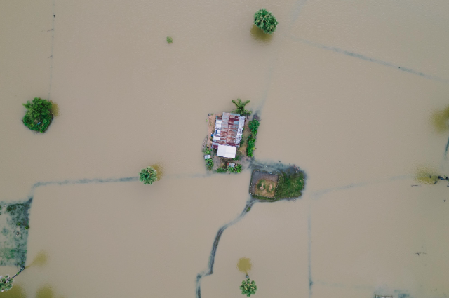
This year's flooding in Upper Assam has brought a different set of rivers into focus. The Dikhow and the Disang, along with other tributaries, rose rapidly during the intense rainfall in July. Sivasagar, Charaideo, Jorhat and Golaghat were among the areas badly affected. In Sivasagar, the Dikhow reached a severe flood level, while the Disang also crossed danger levels.
For people living there, the speed of the flooding was one of the most unsettling parts. Water levels rose quickly in several places, leaving little time for families to move belongings or livestock to safer ground. The Indian Express reported that more than 3.6 lakh people had already been affected during one stage of the flooding in eastern Assam, while rescue teams and boats were being deployed in the worst-hit districts.
The story became even more serious over the following days. At one point, 21 people died within a single 24-hour period, taking the state's flood-related death toll to 31. Several rivers in Upper Assam were simultaneously flowing above danger levels.
What makes this episode worth looking at is not simply the number of people affected. It is the way the flood arrived. The Brahmaputra remains central to Assam's flood geography, but a river does not have to be the biggest one to cause enormous damage. Smaller tributaries can rise quickly when heavy rain falls in their catchment areas. Once that water moves downstream, villages and towns along the river can find themselves dealing with flooding before the situation looks dramatic on a larger river.
That is what happened around parts of Upper Assam. Rainfall in the hills and adjoining areas fed the tributaries flowing towards Assam. The result was a sudden increase in water levels in rivers such as the Dikhow and Disang. The Assam government's own flood information system records both rivers among the state's monitored flood channels, with long histories of high-water events.
Another detail is easy to miss when a flood is reduced to a single number. A flood does not end when the water starts going down.
Roads have to be repaired. Homes have to be cleaned. Crops and livestock may have been lost. Families who spent days in relief camps have to return to places that may no longer look the way they left them. The Assam government has also begun compensation and damage-assessment measures in affected areas.
And the rain itself was not yet finished when the worst of the flooding was being reported. The India Meteorological Department had issued heavy-rain warnings for Assam and Meghalaya through the end of July and into the first days of August. That matters because falling river levels can create a false sense that the danger has passed.
Assam's relationship with floods is old. But not every flood follows the same route. Sometimes the river everyone is watching is not the one that causes the first major shock. Sometimes the smaller rivers tell the story first.
This year's Upper Assam floods have made that very clear. The Dikhow and the Disang may not have the fame of the Brahmaputra, but for thousands of people living beside them, their rise was enough to change everything within hours.
References:
- India Meteorological Department. (2026). Sub-division-wise warnings: Assam & Meghalaya. Ministry of Earth Sciences.
- Indian Express. (2026, July 22). 21 dead in 24 hours as floods worsen sharply in Upper Assam.
- Government of Assam, Water Resources Department. (2026). Flood Information System.