
A Toll That Keeps Climbing
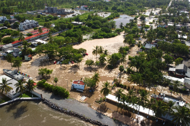
Assam’s flood situation remained grim on Thursday despite receding waters in several parts of the state, with the death toll rising to 78 and more than three lakh people still affected by the deluge. Three more deaths were reported in the past 24 hours — two in Sivasagar district and one in Golaghat, according to the state’s disaster management authority. The severely affected areas include Golaghat, Jorhat, Nagaon, Sivasagar, Charaideo, Biswanath, and Kamrup Metropolitan, with seven districts still submerged.
Charaideo remains the worst-affected district, with 1,37,561 people impacted, followed by Sivasagar with 84,600 and Jorhat with 49,911. More than 21,500 hectares of cropland remain submerged, over 11,000 animals have been washed away, and another 17,000 have been affected, while floodwaters continue to damage embankments, roads, houses and schools across the state.
Not the Flood Assam Was Expecting
What makes this year’s disaster genuinely unusual is not just its scale but its origin. The 2026 Assam floods deviated from the state’s typical pattern — instead of the Brahmaputra overflowing, excessive upstream rainfall in the hills was the primary cause. Generally, Assam’s floods are associated with the Brahmaputra’s main channel overflowing, but in 2026 the floodwaters occurred mainly due to flash floods in the south-bank tributaries.
The flash floods in Upper Assam were triggered primarily by extreme rainfall in Nagaland’s Mon, Wokha, Longleng and Mokokchung districts between 18 and 20 July. IMD data showed Wokha received 239mm of rain over those three days and Mokokchung 167mm, as an upper-air cyclonic circulation over central Assam and adjoining Nagaland produced extreme moisture convergence over already-saturated hill catchments. That water caused south-bank tributaries — particularly the Dikhow, Disang, Janji and Dhansiri — to swell rapidly, crossing danger marks and overflowing embankments before the Brahmaputra itself had even reached its peak flood discharge.
The result was widespread flooding even in areas not ordinarily considered flood-prone, and entire districts of Upper Assam that generations had believed comparatively safe suddenly found themselves submerged. Officials have ruled out one popular explanation circulating on social media: the IMD confirmed there was no cloudburst — defined as more than 100mm of rain in a single hour — describing the event instead as prolonged, extremely heavy rainfall over an extended period.
A Familiar Pattern, With an Unfamiliar Trigger
Assam’s relationship with flooding is, in one sense, nothing new. Most of the state is flood-prone, and its embankment network — totalling over 4,900 kilometres — has been breaching for years as many structures exceed their designed lifespan. Every year, when the monsoon arrives, Assam floods; that has been true for as long as anyone in the state can remember. What has changed, researchers argue, is the mechanism: the threat is no longer only the Brahmaputra itself, but the increasingly volatile behaviour of upstream tributaries responding to rainfall well beyond Assam’s own borders.
Part of what worsened this disaster lies far upstream — large-scale deforestation in Nagaland has altered the hydrology of the rivers flowing down into Upper Assam, reducing the hillsides’ capacity to absorb rainfall before it surges downstream. Reduced water infiltration, loss of natural wetlands, and developmental activities such as road construction have all altered natural drainage systems, contributing to the scale of this year’s disaster.
Receding Water, Renewed Warnings
An ASDMA official said there was no rain in most of the flood-hit Upper Assam districts on Wednesday, allowing water levels to recede and giving some respite to residents. Even so, many people remained unable to return home, as Chief Minister Himanta Biswa Sarma noted their houses were either damaged or filled with mud and silt.
That respite may be short-lived. The IMD has predicted heavy to very heavy rainfall with thunderstorms from 30 July to 1 August across Assam and parts of Arunachal Pradesh, which may affect Tinsukia, Dhemaji and Lakhimpur. An ‘orange alert’ has been issued for Tinsukia, along with Mon, Mokokchung and Wokha in Nagaland, which could affect the neighbouring Assam districts of Charaideo, Sivasagar, Jorhat and Golaghat. The IMD has warned that the fresh rain could aggravate waterlogging, flash floods and localised landslides in vulnerable pockets.
Relief Efforts and the Politics of Response
More than 16,500 displaced people are currently in 71 relief camps, while another over 72,000 are being assisted through 30 relief distribution centres. Union Home Minister Amit Shah spoke with Chief Minister Sarma this week to take stock of the situation and assured him of all possible assistance from the Centre — the second such call from Shah in seven days.
Even so, the state’s chronic vulnerability to flooding has fed a familiar strain of public frustration — the sense that each disaster arrives, dominates the news cycle, prompts official visits and promises, then quietly recedes from public attention until the following monsoon repeats the cycle. Analysts argue that reversing that cycle will require sustained, unglamorous investment: permanent reinforcement and regular desilting of the Brahmaputra and its tributaries, better integration of upstream rainfall data from neighbouring states to allow earlier warnings, and quicker damage assessments and faster compensation to help affected communities recover sooner — the kind of infrastructure spending that rarely survives the gap between one flood season and the next.
A Crisis Still Unfolding
For now, Assam’s flood emergency remains open rather than closed. Waters have receded in parts of Upper Assam, relief distribution is underway, and compensation processes have begun for families who lost homes, crops and livestock. But with the IMD warning of fresh heavy rainfall through August 1 in districts bordering Nagaland and Arunachal Pradesh, officials are bracing for the possibility that this year’s death toll, already the state’s highest in recent seasons, may not be final. What is already clear is that 2026 has forced a rethink of what “flood-prone” means in Assam — a lesson written not by the Brahmaputra this time, but by rivers few people were watching closely enough.
References:
- The Federal. “Assam flood leaves 78 dead; IMD predicts more rains till August 3,” July 30, 2026.
- The Week. “Assam floods update: Death toll reaches 78, over 3 lakh impacted as IMD issues warning for heavy downpours,” July 30, 2026.
- National Herald India. “Assam flood death toll rises to 78; over 3 lakh still affected as IMD warns of more rain,” July 30, 2026.
- India TV News. “Death toll rises to 78 with three more deaths in Assam floods, IMD predicts heavy rains for the state,” July 30, 2026.
- Onmanorama. “Assam flood toll rises to 78, situation remains grim; Arunachal, Nagaland brace for heavy rains,” July 30, 2026.
- Assam Tribune. “Assam flood toll rises to 78; IMD forecasts more heavy rain,” July 30, 2026.
- Outlook India. “Outlook Explains | Why Assam Floods Every Year Despite Decades Of Flood-Control Projects.”
- India Today NE. “Explained: How Extreme Rain and Saturated Hills in Nagaland Flooded Upper Assam,” July 24, 2026.
- Mahabahu.com. “Assam Floods 2026: Why the State Keeps Drowning Despite Years of Promises.”
- CoverFox. “Assam Floods 2026: Death Toll, Damage, Causes and Latest Updates.”