
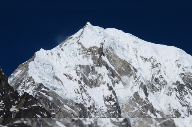
Hollywood imagined the end of the world. The Himalayas offered a far quieter—and far more frightening—reminder of how little warning nature sometimes gives.
In Roland Emmerich’s 2012, the end of the world arrives with a spectacle. Cities split open, mountains collapse, enormous waves swallow coastlines, and millions run for their lives as civilisation appears to crumble before their eyes. The film is deliberately exaggerated, scientifically fictional and designed to make catastrophe look almost unimaginable.
But sometimes reality does not need Hollywood’s imagination to look terrifying.
On 26 August 2026, high in the Himalayas near Nepal’s border with China, a massive mass of ice and rock detached from the mountain landscape. What followed was not the fictional destruction of the entire planet, but something much more real: a cascading chain of geological and hydrological events that sent water, ice, rock and debris rushing through a Himalayan river valley.
The frightening part was not simply the amount of water.
It was where that water came from.
Early reports and explanations varied. Was an earthquake responsible? Was this another glacial lake outburst flood, a hazard increasingly associated with a warming Himalaya? As satellite images and scientific assessments emerged, the picture became more complicated. Evidence increasingly pointed towards a massive ice-and-rock avalanche that struck the Lhende River, temporarily obstructing its flow and contributing to a sudden downstream flood and debris surge.
In other words, the mountain itself became part of the flood.
For communities downstream, the distinction between glacier, landslide, river and flood was no longer academic. Roads and bridges were destroyed, infrastructure was swept away, and people found themselves confronting a disaster that had travelled from the high mountains to the valley floor in an extraordinarily short period.
And that is where the comparison with 2012 becomes interesting—not because the film predicted Nepal, and certainly not because its fictional science was somehow proven correct.
It didn't.
The film imagined a planetary apocalypse. Nepal experienced a local geological chain reaction.
Yet both leave us with the same uncomfortable question:
What happens when the landscape we depend upon suddenly stops behaving the way we expect it to?
The answer, in the Himalayas, can travel downstream at terrifying speed.
2012 Did Not Predict Nepal
Before drawing any parallels between 2012 and the disaster in Nepal, one distinction must be made clear: the film did not predict what happened in the Himalayas.
Released in 2009, Roland Emmerich’s 2012 is a work of disaster fiction built around a fictional chain of planetary catastrophes. Its story draws on popular interpretations of the ancient Maya calendar and imagines a series of earthquakes, volcanic eruptions, tsunamis and other events bringing civilisation to the brink of extinction. Its scientific premise has no connection to the geological processes that produced the August 2026 disaster in Nepal.
There is therefore no scientific basis for claiming that 2012 foresaw, predicted or somehow anticipated the Himalayan flash flood.
The comparison in this article serves a different purpose.
It is about scale, not prophecy.
Hollywood used computer-generated destruction to show audiences what civilisation might look like when nature becomes overwhelmingly powerful. Nepal provided a real-world reminder that extraordinary destruction does not require a fictional apocalypse. A collapsing mass of ice and rock, a river suddenly obstructed and released, and a valley lying downstream were enough to create devastation on a scale that could look almost cinematic.
That distinction matters because disasters do not become more meaningful when we attach supernatural explanations to them. They become more meaningful when we understand why they happened, why communities were vulnerable, what scientists knew beforehand, and what could be done differently next time.
So this is not a story about a movie predicting the future.
It is a story about how, sometimes, reality can become frightening enough without fiction.
The Morning the Mountain Moved
At first, there was nothing about the morning of 26 August 2026 that announced the scale of what was about to happen.
There was no extraordinary rainstorm over Rasuwa. Nepal’s Department of Hydrology and Meteorology reported that the area had not experienced significant rainfall when the flood struck. Yet, at around 9:15 a.m., an enormous surge of water suddenly entered the Bhote Koshi River from the direction of the Tibetan side, rapidly transforming an ordinary Himalayan morning into a disaster.
The clue to what had happened lay far upstream.
Satellite imagery examined after the event showed evidence of a massive ice-and-rock avalanche in the high mountains, roughly 20 kilometres northeast of the Rasuwagadhi border crossing. The material appears to have plunged into the Lhende River, a tributary of the Bhote Koshi, carrying an enormous mixture of ice, rock and debris into the river system.
What happened next was a chain reaction.
The avalanche appears to have obstructed the river, effectively creating a temporary natural dam. Water accumulated behind the blockage. Then the barrier gave way.
The result was not a conventional river flood gradually rising over its banks. It was a sudden debris-laden surge—water moving together with mud, rocks, ice and other material swept from the mountain. Nepalese officials noted that the presence of this debris made the flood considerably more destructive than a surge of clear water would have been.
The flood then travelled downstream through the Lhende and Bhote Koshi river system, reaching communities including Timure, Rasuwagadhi and Syabrubesi before threatening areas along the Trishuli corridor. The Nepal Red Cross reported flood waves estimated at 8–10 metres in some locations, while roads, bridges, settlements, police facilities and hydropower infrastructure were severely affected.
And then came one of the most remarkable details of the disaster.
The event initially produced confusion even among scientists.
A seismic event had been recorded at approximately 8:37 a.m. on the Tibetan side of the border. Early reports therefore considered whether an earthquake might have triggered the catastrophe. But subsequent analysis of the seismic signal pointed towards a different explanation: the signal was associated with the massive mass movement itself rather than being evidence of a conventional tectonic earthquake. The US Geological Survey ultimately classified the event as a landslide-generated seismic event.
That distinction changes the entire story.
It means the question was not simply, “What earthquake caused the flood?”
The more unsettling question became:
“What happened to the mountain before the river suddenly rose?”
The answer emerging from satellite imagery and scientific investigation was a chain of events beginning high above the valley: ice and rock detached from the mountain, slammed into the river system, temporarily altered its course, and transformed a Himalayan river into a rapidly moving carrier of water, stone and debris.
In the space between the high mountain and the valley below, a geological event had become a humanitarian disaster.
And by the time people downstream could see what was coming, the mountain had already moved.
The First Mystery: Was It an Earthquake?
At first, the answer seemed obvious.
A seismic signal had been detected near the Nepal–China border at around 8:37 a.m. on 26 August. The event was initially reported as an earthquake, with early estimates putting its magnitude at around 4.4. In a region as seismically active as the Himalayas, an earthquake appeared to be a logical explanation for a sudden geological disaster.
But there was a problem.
The evidence emerging from the ground—and later from satellites—did not fit the simple story of an earthquake triggering a flood.
The U.S. Geological Survey (USGS) went back to the seismic data and examined the character of the waves recorded by nearby stations. The analysis eventually led to a striking conclusion: the event had generated seismic energy equivalent to approximately a magnitude 5.2 earthquake, but it was not a conventional tectonic earthquake. Instead, the seismic signal was produced by the enormous movement of ice, rock and debris itself.
In other words, the mountain had effectively created its own earthquake-like signal.
The distinction may sound technical, but it changes our understanding of the disaster completely.
An earthquake occurs when stress accumulated within the Earth's crust is suddenly released along a fault, producing seismic waves. What happened in this case was different: a massive slope failure involving a glacier generated enough energy and movement to produce a seismic signal that could initially be mistaken for an earthquake.
The USGS later described the event as a glacial collapse/debris-flow or rapid slope failure involving a glacier, while noting that it was still unclear whether the initial failure should be classified precisely as a landslide incorporating glacier ice or as a glacial collapse.
And that uncertainty is important.
Disasters rarely arrive with a neat label attached to them.
The first signal may say earthquake. The satellite image may suggest landslide. The river may tell another part of the story. Only when these pieces are assembled does the larger picture emerge.
In Nepal, that picture was becoming increasingly clear: the seismic signal was not the beginning of the disaster—it was a consequence of the mountain's movement.
The first mystery, therefore, was not simply what shook the ground.
It was something far more unsettling:
What could move with enough force to make the Earth itself appear to have shaken?
The answer was waiting high above the river valley—where a mass of ice and rock had broken loose and begun its descent.
The Second Mystery: Was This a GLOF?
Once the earthquake theory began to fall apart, another explanation seemed almost inevitable: a Glacial Lake Outburst Flood, or GLOF.
The term is familiar in the Himalayas. A glacial lake forms when meltwater collects behind a natural barrier of ice, rock or sediment. If that barrier suddenly fails, millions of cubic metres of water can rush downstream, producing a flood with devastating force. As Himalayan glaciers retreat and some glacial lakes expand, GLOFs have become one of the region's most closely watched hazards.
So when a sudden flood emerged from a high-altitude glacier environment on 26 August, the label seemed to fit.
But the evidence began to tell a more complicated story.
A conventional GLOF requires a lake—a significant body of water that accumulates behind a natural dam and then suddenly escapes. Yet early satellite assessments of the August disaster did not identify a clear pre-existing glacial lake at the source large enough to explain the scale and behaviour of the flood. The U.S. Geological Survey instead described the event as a catastrophic debris flow and flood likely triggered by rapid slope failure involving a glacier, while noting that scientists were still determining whether the initial failure should be classified as a landslide incorporating glacier ice or a glacial collapse.
That distinction matters.
Because this may not have been a simple story of “a lake burst.”
Instead, the emerging evidence points towards something more complex: a mass of ice and rock broke loose high on the mountain, moved rapidly downslope and entered the river system. The material itself contained ice and water, while the violent movement picked up additional rock, sediment and water along the existing channels. What eventually travelled downstream was therefore not simply floodwater, but a fast-moving mixture of water, ice, mud, boulders and mountain debris.
In a sense, the distinction changes the story from a lake escaping its natural container to a mountain collapsing into its own river.
And that is what makes the event particularly difficult to classify.
A glacier can melt.
A lake can burst.
A slope can collapse.
A river can flood.
But in the Himalayas, these processes can occur in sequence—and sometimes almost simultaneously.
The August disaster appears to have demonstrated exactly that kind of cascading hazard. The initial collapse generated a powerful debris flow; the material then entered established river channels and helped transform them into conduits for a destructive flood that travelled nearly 100 kilometres downstream.
There is another reason this distinction matters.
Calling every glacier-related flood a GLOF can make Himalayan disasters sound simpler than they really are. It suggests that monitoring the world's dangerous glacial lakes alone is enough to protect downstream communities.
It isn't.
A mountain does not need to contain a giant lake to become dangerous.
A glacier can collapse.
A slope can fail.
A river can be temporarily blocked.
A natural barrier can form and disappear.
And one process can trigger another.
That is the deeper lesson emerging from Nepal.
The greatest Himalayan hazards may not always come from a single disaster mechanism. They can come from several natural processes colliding within minutes.
And by the time scientists give the event a name, the river may already have carried the consequences far downstream.
The “Wall of Water”: What Actually Made the Flood So Deadly
A flood is frightening because of water.
The Nepal disaster was frightening because the water was carrying the mountain with it.
What rushed downstream on 26 August was not simply a swollen river. According to the U.S. Geological Survey, the initial slope failure involved glacier ice and generated a rapidly moving debris flow that picked up additional water and material as it travelled through existing stream and river channels. The resulting flood was laden with boulders, ice, mud and other rubble and travelled nearly 100 kilometres downstream.
That difference is crucial.
Clear water can flood a road.
A debris-filled surge can destroy the road itself.
Water can rise around a bridge.
Boulders moving at enormous speed can tear the bridge apart.
A conventional flood may give people some time to understand that the river is rising. A sudden debris flow gives them something far more dangerous: speed, mass and momentum arriving together.
The chain of destruction began high above the valley. Ice and rock broke loose and moved rapidly downslope. As the material descended, it interacted with the river system, incorporating more water, sediment and debris. What emerged downstream was therefore no longer simply the product of a collapsing glacier or a swollen river. It had become a moving mixture of everything the mountain and river could surrender to gravity.
And gravity did not slow it down.
The USGS estimates that the debris flow and flooding travelled approximately 100 kilometres, reaching populated areas along the Lhende Khola and Trishuli Khola river systems and affecting the Rasuwagadhi border area.
This is what makes the phrase “wall of water” both useful and misleading.
It was a wall of destruction—but not a single, clean wall of water.
It was water with weight behind it.
Every boulder carried by the flow could become a projectile. Every fallen tree could become an obstruction. Every kilogram of sediment could make the moving mass denser and more destructive. And once bridges, roads or riverbanks were damaged, the flood could alter its own path, spreading the destruction beyond the original channel.
The disaster therefore became a cascade within a cascade:
Ice and rock collapsed.
The river was disrupted.
Water and debris accelerated downstream.
The river carried more material with it.
Infrastructure began to fail.
The destruction then travelled with the flood.
This explains why the consequences were not confined to the place where the mountain first collapsed. The original geological event happened high in the Himalayas, but its effects travelled far beyond the point of collapse.
That is perhaps the most unsettling lesson of the disaster.
A mountain does not have to fall on a village to destroy it.
It can fall into a river hundreds or thousands of metres above that village—and allow the river to carry the mountain the rest of the way.
The Himalayas did not simply release water that morning.
They released ice, rock, sediment and water together—and sent them downstream at once.
From the Mountain to the Valley: How Far Did the Disaster Travel?
The collapse began in a remote, high-altitude landscape. Its consequences did not remain there.
The flood entered the Lhende Khola and Bhote Koshi river system, moving through Rasuwa before reaching the wider Trishuli corridor. The river system transformed a local mountain collapse into a disaster affecting communities and infrastructure far downstream.
This geography is crucial to understanding the disaster.
A person standing far from the original collapse could still be endangered by it. A road could be destroyed kilometres away. A bridge could fail without the mountain ever physically reaching it.
The river became the connection between the mountain event and the human disaster.
The mountain moved once. The river carried its consequences much farther.
When Infrastructure Became the Weakest Link
The flood did not encounter an untouched wilderness.
Along the river were roads, bridges, hydropower facilities, settlements and the important Rasuwagadhi border corridor. Much of this infrastructure was built precisely because rivers are essential to Himalayan communities—but that also placed critical assets directly within the path of cascading hazards.
Bridges disappeared. Roads were cut off. Hydropower projects were damaged. Rescue teams themselves faced difficulties because the routes they normally depended upon had been destroyed.
This created a second disaster inside the first.
The flood did not only destroy homes and infrastructure; it damaged the very systems needed to reach the people who needed help.
That is one reason the consequences of a sudden Himalayan disaster can continue long after the water has receded.
Could Anyone Have Warned Them?
This is perhaps the most difficult question.
Not whether scientists could have predicted the exact minute a glacier or mountainside would collapse. Such precise prediction is currently unrealistic.
The more practical question is whether systems could have detected the danger quickly enough to warn people downstream.
Nepal and the wider Himalayan region already use satellite monitoring, river gauges and disaster-warning systems. But a sudden high-altitude collapse creates a particular challenge: the trigger can occur in an extremely remote location, while the people at risk may be tens of kilometres downstream.
The warning therefore has to travel faster than the flood.
That requires real-time monitoring of vulnerable slopes and glaciers, rapid analysis of satellite and seismic data, reliable river-level sensors and—most importantly—communication systems that can reach ordinary people immediately.
The lesson is not that technology should predict every disaster.
It is that when prediction is impossible, minutes of warning can still save lives.
Climate Change: Cause or Risk Multiplier?
It would be tempting to call the Nepal disaster simply a consequence of climate change.
Science demands more caution.
A specific glacier collapse cannot automatically be attributed to climate change without detailed attribution research. Mountains are naturally unstable, and ice-and-rock failures have occurred long before modern warming.
But climate change is altering the Himalayan environment in ways that can affect future hazard patterns.
Glaciers are retreating. Permafrost is changing. High-altitude landscapes are becoming increasingly unstable in some areas. At the same time, communities and infrastructure continue to expand into mountain valleys.
So the more accurate question is not:
“Did climate change cause this flood?”
It is:
“How is a changing Himalayan environment altering the risks that communities already face?”
That distinction matters. Climate change does not have to be the sole cause of a disaster to become part of its risk equation.
The Number 26: Coincidence, Not a Code
Then there is the detail that caught the public imagination: 26 August.
India and South Asia have witnessed several major tragedies on the 26th of a month—the 2001 Bhuj earthquake on 26 January, the 2004 Indian Ocean tsunami on 26 December, the 2005 Mumbai floods on 26 July, and the 2008 Mumbai attacks beginning on 26 November.
Now, another devastating event has occurred on 26 August.
It is an unsettling coincidence.
But it is still a coincidence.
There is no scientific evidence that the number 26 has predictive, supernatural or geological significance. The human brain naturally searches for patterns, especially after traumatic events. When unrelated disasters share a date, the coincidence can feel meaningful even when there is no causal connection.
The number 26 did not cause Nepal's flood.
The mountain did.
And understanding that difference is more important than finding a pattern in the calendar.
The Flood Did Not Stop at the Border
One of the most important lessons of the disaster is geographical.
The event occurred in a region divided by an international boundary, but the river system does not recognise that boundary.
The Lhende and Bhote Koshi systems connect with the Trishuli and ultimately the Narayani/Gandak river system, which continues into India.
That makes Himalayan disaster management inherently transboundary.
A collapse in the high mountains can affect people living far beyond the location where the original event occurred. Warnings, river data and satellite information therefore cannot remain trapped within national systems.
Nepal, China and India share more than mountains.
They share the consequences of what happens to those mountains.
The disaster therefore raises a larger policy question: can countries sharing Himalayan river systems exchange critical hazard information quickly enough when every minute matters?
The Himalayas Are Not Scenery
For much of the world, the Himalayas are photographs.
Snow-covered peaks.
Trekking routes.
Tourist destinations.
Postcard landscapes.
For millions of people, they are something entirely different.
They are watersheds, homes, roads, farms, energy sources and livelihoods.
The tragedy in Nepal exposes a dangerous misconception: mountains may look permanent, but mountain landscapes are constantly changing.
Glaciers move. Slopes fail. Rivers shift. Rock fractures. Snow and ice accumulate and disappear.
Human infrastructure, however, is often designed around the assumption that the landscape will remain stable.
That assumption becomes increasingly dangerous in a changing climate.
The Himalayas are not a backdrop to human civilisation. They are an active part of it.
What Can Actually Be Done?
There is no technology capable of stopping a mountain from collapsing.
But disaster management does not require stopping the trigger. It requires reducing the number of people and systems exposed to it.
Five measures stand out.
- First, monitor high-risk slopes and glaciers. Satellite imagery can identify changes that are impossible to observe continuously from the ground.
- Second, strengthen early-warning systems. River gauges, seismic monitoring and automated alerts can turn a few minutes of information into a chance to evacuate.
- Third, improve cross-border data sharing. A hazard originating in one country can become a flood emergency in another.
- Fourth, reconsider where critical infrastructure is built. Roads, bridges and hydropower facilities located directly beside vulnerable rivers need disaster scenarios that account for sudden debris flows, not only ordinary floods.
- Fifth, plan for cascading disasters. A collapsed bridge can block rescue operations. A landslide can block a river. A temporary blockage can create another flood.
The goal is not to predict every disaster.
It is to ensure that an unpredictable disaster does not become an unprepared disaster.
The Real Vulnerability Was Not the Mountain
The mountain was always capable of moving.
The deeper vulnerability lay in everything below it.
People living beside rivers cannot simply move away from every possible hazard. Roads have to follow valleys. Hydropower projects need rivers. Border routes have to cross difficult terrain. Communities depend on the same geography that exposes them to risk.
This creates an uncomfortable contradiction:
The river that sustains a community can also destroy it.
The answer, therefore, cannot simply be to abandon the mountains.
It has to be to understand them better.
Hazard maps must influence construction. Infrastructure must be designed for extreme events, not historical averages alone. Warning systems must reach the last person in the valley—not merely the government office that receives the first alert.
A disaster becomes a catastrophe when hazard meets exposure and vulnerability.
Nepal had all three.
Hollywood Needed a Doomsday. The Himalayas Needed Only Gravity.
2012 needed a fictional planetary catastrophe to show humanity confronting forces beyond its control.
Nepal needed no fiction.
There was no collapsing continent.
No imaginary planet approaching Earth.
No supernatural prediction.
There was ice.
There was rock.
There was water.
And there was gravity.
A mountain moved, a river responded, and the consequences travelled downstream.
That is what makes the comparison with 2012 so uncomfortable. The film's destruction is deliberately impossible. The Himalayan disaster was not.
Reality did not need to exaggerate itself to look cinematic.
The Warning We Should Take Home
The most important lesson from 26 August is not that nature is unpredictable.
Humanity has always known that.
The lesson is that a disaster can begin somewhere almost nobody is watching and become a crisis for people who never saw its source.
A collapse high in the Himalayas became a flood in the valley. A geological event became an infrastructure crisis. A local hazard became a transboundary concern.
And perhaps that is the real meaning behind the uncomfortable comparison with 2012.
Hollywood imagined a world ending in a single spectacular moment.
The Himalayas showed something more realistic:
Catastrophe does not always arrive as one enormous event. Sometimes it begins with a mountain moving—and becomes deadly because everything downstream is connected.
The answer is not to fear the mountains.
It is to listen to them better.