
The Indispensable Role of Forests and the current dilapidation
It is a well-established fact that forests form an indispensable part of our lives and that every facet of mankind depends on forests, directly or indirectly. Forests cover one-third of the total land surface and provide mankind, literally, with everything that is needed to thrive on the planet, let alone live. From oxygen required for survival to food for daily sustenance, forests ensure resilient agricultural productivity through watershed regulating mechanisms. It is the forests that maintain the optimum climate conditions by their regulating effect, regionally as well as provincially. The ill results of human inhabitation, be it pollution or the alarmingly increasing carbon dioxide levels, all of it is wiped out by forests being the second largest carbon sink after oceans. The time has come when the once noble medicines created by humans have started showing disastrous and deleterious effects on the well-being of man. Again it is the forests that provide us with an alternative by presenting an array of medicinal plants that solve the majority of such challenges and are becoming inextricably linked with our healthcare requirements. In addition to this, some 70 million people, worldwide, call forests home! Therefore, it is undisputed to say that forests in particular, and biodiversity, in general, are the only safe ventures for humans to avail without any threat of long-term and newfound challenges.
However, like any other scenario, humans have mercilessly harmed and hampered this blessing as well. When we destroy a forest, it is not just the trees that vanish. We deprive ourselves of all the complimentary ecosystem services that would cost millions if provided anthropogenically. Hence, all our conservation efforts must be contemporized, advanced, and streamlined for the positive trend to be effective and efficient.
In this article, I attempt to unfold the role of the Forest Survey of India in examining, maintaining, and, planning forests in India to maintain sustainability for us and the upcoming generations.
FSI and its mandate
Established on June 1, 1981, and headquartered at Dehradun, Uttarakhand, the Forest Survey of India (FSI) is a premier national organization under the MoEFCC, with the mandate of assessing and monitoring the forests of the country regularly. In addition to this, it is also involved in the services of research, training, extension, and capacity building. The FSI succeeded the Pre Investment Survey of Forest Resources (PISFR), a project initiated by the Government of India with the sponsorship of FAO and UNDP in the year 1965. PISFR mainly focused on ascertaining the availability of raw materials for wood-based industries in selected regions of the country. In the year 1976, the National Commission on Agriculture put forth the recommendation of creating a National Forest Survey Organization aiming at regular and comprehensive surveys of the forest resources of the entire nation, giving birth to the FSI. In 1986, the government redefined its mandate to cope with the changing needs and requirements of the country. Today, FSI serves the nation with its invaluable contribution, summed up as follows-
- Preparation of biennial State Forest Report, assessing the forest cover in the country and monitoring the changes therein.
- Inventory of Trees outside Forests, in rural as well as urban areas.
- Collection, compilation, storage, and, dissemination of spatial database.
- Preparing thematic maps on a 1:50,000 scale using aerial photography.
- Strengthening research and development infrastructure on applied forest survey techniques.
- Conducting training of forestry personnel in the application of technologies.
- Supporting State Forest Departments (SFDs) in conducting surveys, mapping, and, inventory.
FSI is headed by a Director General supported by two Joint Directors and eight Deputy Directors at headquarters. Zonal offices are headed by a Regional Director and supported by one or two Deputy Directors. The total sanctioned strength of the organization is 436, which includes members of the Indian Forest Service and Indian Statistical Service on deputation. At present, Shri Anoop Singh, IFS is the Director General of FSI.
- The ISFR Reports - The Indian State Forest Reports (ISFR) have been published by the FSI on a biennial basis since 1987. Based on the interpretation of Remote Sensing Satellite data and field-based National Forest Inventory (NFI), an in-depth assessment of the forest and tree resources of the country is published in the ISFR. Recently, the ISFR 2023, the 18th report in the series was released by Shri Bhupendra Yadav, Minister for Environment, Forests, and, Climate Change, at Forest Research Institute, Dehradun.
- Tools and Techniques - The LISS-III satellite data utilized in the 18th cycle of Forest Cover Mapping (FCM) was procured from the National Remote Sensing Center (NRSC) in Hyderabad. This satellite data was acquired for all states within the time frame of October 2021 to December 2021. This specific time window was chosen because it typically offers cloud-free satellite data and full vegetation foliage, resulting in enhanced reflectance and precise satellite image interpretation. In total, the Forest Cover Mapping exercise made use of 306 IRS Resources at 2 LISS-III Images, covering the entire geographical expanse of the country, to achieve comprehensive and accurate forest cover assessments. The selection of medium spatial resolution LISS-III data at a 1:50,000 scale is influenced by several key factors, such as the vast geographical expanse of the country, the two-year time gap between consecutive mapping cycles, and the need for specific reporting of forest cover tailored to the country’s requirements.
Indian State Forest Report, 2023
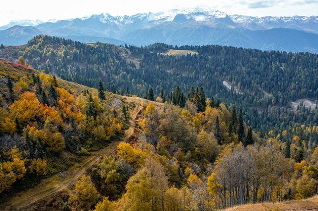
Important Characteristics of India’s ForestsThe diversity in flora and fauna for forest ecosystems is the result of the interaction of various physiographic, edaphic, and climatic conditions that are found in the country. Variation in the country’s forests is seen from tropical evergreen forests in the Andaman & Nicobar Islands, the Western Ghats, and the North-Eastern States, to dry alpine scrub high in the Himalayan region. Between the two extremes, the country has semi-evergreen forests, moist deciduous forests, dry deciduous forests, thorn forests, subtropical pine forests in the lower mountain zone, and temperate montane forests in the mid-mountain zone having an altitude of more than 3500 m (above mean sea level).
Relevant Important Terms and Concepts (in the context of the Report)
- Forest Cover - Forest cover refers to all lands, more than or equal to one hectare in area, with a tree canopy of more than or equal to 10%, irrespective of ownership and legal status; and includes orchards, bamboo, and palm. Thus, ‘Forest cover’ indicates the presence of trees on any land, irrespective of ownership of land; and irrespective of the fact whether the land is notified as a forest land or not. . FSI can't distinguish a tree-clad area based on the legal status of land using the remote sensing techniques.
- Recorded Forest Area (RFA) - The ‘recorded forest area’ (RFA) refers to all the geographic areas recorded as ‘forest’ in government records. The ‘recorded forest area’ largely consists of the ‘Reserved Forests’ (RF) and the ‘Protected Forests’ (PF), constituted under the provisions of the Indian Forest Act, of 1927. Besides the RFs and PFs, the recorded forest area may also include all such areas which have been recorded as ‘Unclassed Forests’, ‘Village Forests’, or by any other nomenclature of such description and all such areas which have been recorded as forest in the revenue records or have been constituted so under any State Act or local law. A recorded forest area may, or may not, have tree cover. Besides being richly forested, recorded forest areas may have less than 10% canopy cover, pastures, desert lands, blanks, wetlands, rivers, riverbeds, creeks, snow-clad areas, etc. FSI obtains the information about the RFA from the respective State/ UT Governments, as they are the custodians of this information.
- Tree Cover - Tree cover refers to the area covered by trees outside recorded forest areas. These areas range from that covered by a single tree to patches of trees less than 1 ha, as areas more than 1 ha are already covered in the Forest cover. Such small patches may comprise bock plantations, linear plantations, and scattered trees not delineated as forest cover during the interpretation of satellite data.
- Green Wash - In cases where usable digitized boundaries of recorded forest areas (RFAs) were not available, FSI adopted an alternative approach, using the “greenwash” boundaries, which are areas represented in green on the Survey of India topographic sheets, as a proxy for RFAs.
- Classification of Forest Cover-
| Very Dense Forest | Canopy density ≥ 70 % |
| Moderately Dense Forest | 40 % ≤ Canopy density < 70 % |
| Open Forest | 10 % ≤ Canopy density < 40 % |
| Scrub | Canopy density < 10 %, generally with shrubs interspersed with trees |
| Non-forest | lands that do not fall into any of the above classes. It includes areas such as cropland, settlements, water bodies, grasslands, snow-clad areas, deserts, etc. |
Salient Findings-
- The total forest and tree cover of the country is 8,27,356.95 km2 which is 25.17% of the geographical area of the country. In this, the Total forest cover is 7,15,342.61 km2 (21.76%) and the Tree cover is 1,12,014.34 km2 (3.41%).
- The total forest and tree cover of the country has increased by 1445.81 km2 as compared to the last assessment of 2021.
- The maximum increase in forest and tree cover has been observed in the States of Chhattisgarh, followed by Uttar Pradesh, Odisha, and Rajasthan.
- The maximum decrease in forest and tree cover has been noticed in the state of Madhya Pradesh, followed by Karnataka, Ladakh, and Nagaland.
- The extent of TOF (forest cover outside the RFA & GW and tree cover) is 30.70 M ha, which is 37.11% of the total forest and tree cover in the country.
- In general, twenty-one States and UTs have shown an increasing trend in tree cover, which indicates that agroforestry, is being promoted in these States.
- Forest cover in the hills districts of the country is 2,83,713.20 km2, which is 40% of the total geographical area of these districts.
- The total forest and tree cover in the North Eastern region is 1,74,394.70 km2, which is 67% of the geographical area of these states.
- Forest cover in all districts under Western Ghats Eco-Sensitive Areas (WGESA) has been estimated as 44,043.99 km2 (73%).
- The total Mangrove cover of the country is 4,991.68 km2, which accounts for 0.15 % of the country’s total geographical area. In comparison to the 2021 assessment, there has been a net decrease of 7.43 km2 in the country’s Mangrove coverage.
- The top three States where fire incidences have been observed the most in the 2023- 24 season are Uttarakhand, Odisha, and Chhattisgarh.
- In regions spanning central, northern, and eastern India, the gathering of tendu leaves (Diospyros melanoxylon) and mahua flowers (Madhuca longifolia) represents a significant contributor to forest fires. Pan-India, an estimated 4.35 Mha area is affected by the fires due to shifting cultivation practices by the local farmers. In the Northeastern region of India, one of the major causes of forest fire and forest degradation is Jhum cultivation. Due to the shortening of the Jhum cycles, every year, large forest areas are slashed and burnt for cultivation, enhancing the chances of frequent and severe fires across ecologically sensitive and biodiversity-rich forests in the region.
- Although there are multiple reasons for the occurrence of human-induced forest fires, forest fires in the country can be segregated into four prominent clusters:
- fires in the Western Himalayan region (Jammu & Kashmir, Uttarakhand, and Himachal Pradesh) on account of fires in pine forests and by transhumance pastoralists;
- fires in the western part of the country on account of drier vegetation and extensive grassland habitats;
- fires in Central Indian states, Western and Eastern Ghats on account of large-scale collection of NTFPs; and
- Widespread fires in North-Eastern states due to shifting cultivation.
- Nearly 93% of the fires observed are surface fires and are classified as low-burnt areas.
- There is a total increase of 262.32 M m3 (4.25%) in the growing stock of the country as compared to the estimates reported in ISFR 2021.
- Arunachal Pradesh has the maximum growing stock of forests, followed by Uttarakhand, Chhattisgarh, and Madhya Pradesh.
- Inside the forests, Shorea robusta has the maximum contribution in total volume (11.43%), followed by Tectona grandis (4.46%), Pinus roxburghii (4.43%) and Terminalia tomentosa (3.59%).
- In the Trees Outside Forests, Mangifera indica contributes a maximum volume of 13.25% to the total volume followed by Azadirachta indica (7.00%), Madhuca latifolia / Madhuca longifolia / Madhuca indica (4.37 %) and Cocos nucifera (4.16 %).
- The total bamboo-bearing area of the country has been estimated to be 1,54,670 km2. There is an increase of 5,227 km2 in the bamboo-bearing area of the country as compared to the previous assessment reported in ISFR 2021.
- There is a total increase of 21,286.57 km2 (20.02%) in the total tree green cover under agroforestry of the country as compared to the estimates reported in ISFR 2013.
- Maharashtra has the highest number of trees under agroforestry (1,165 million), followed by Karnataka (901 million), Uttar Pradesh (547 million) and Rajasthan (542 million).
- The top five prevalent species in agroforestry are Mangifera indica, followed by Azadirachta indica, Prosopis juliflora / Neltuma juliflora, Areca catechu, and Eucalyptus species.
- The carbon stock for 2023 has been estimated as 7,285.5 Mt. There is an increase of 81.5 Mt of carbon stock as compared to the estimates of the previous assessment.
- India has six major megacities as of September 2023. As per the United Nations’ criteria of urban agglomerations, a Megacity has a population of 10 million or more. The major megacities are Bengaluru, Chennai, Delhi, Kolkata, Hyderabad, and Mumbai. Ahmedabad is also a rapidly growing city, on the verge of becoming a major mega city. From the current assessment, it can be seen that Delhi has the largest forest cover (194.15 km2 ) followed by Mumbai (110.84 km2 ) and Bengaluru (89.61 km2).
- 16.84 % area of the Forest does not have soil erosion. 23.25 % area is experiencing moderate to heavy erosion, and 54.42 % is experiencing Mild erosion. It may be noted that the instances of heavy and moderate soil erosion have increased in the last decade.
- It is revealed that 6.17 % of the forest area is heavily influenced by illicit felling, 25 % area experiences no illicit felling, and 21.42 % of the Forest area is affected by moderate illicit felling.
Note-
As per the 2011 census, there were 218 tribal districts. However, districts have been bifurcated and new districts have been constituted in many States since 2011. FSI is using the latest boundary layer provided by Survey of India, which includes the newly formed districts. However, the notification of the districts as tribal districts is not available with FSI and was not provided by the Ministry of Tribal Affairs. Hence, forest cover change in tribal districts is not given. However, this information can be extracted from the district-wise forest cover figures given.
Important Case Studies-
- Rubber Plantation in Tripura - FSI carried out a study in the year 2019-20 on request of the Tripura Forest Department to map Rubber (Hevea brasiliensis) plantations on a wall-to-wall basis of the entire State using LISS-IV data along with extensive ground truth. The satellite imageries and field photographs show how large tracts of forest land have been converted into plantations. The study revealed that the area under rubber plantations is 11.90% of the state’s geographical area and 16.17% of the state’s total forest area. Among all the districts of Tripura, South Tripura has the maximum spatial extent of rubber plantations totaling 355.27 km2. The total forest cover of the state, inside the Recorded Forest Area (RFA), is 5,433 km2, out of which 482.22 km2 is rubber plantations which account for 8.88% of the RFA. Field visit photographs taken during the 18th cycle of forest cover mapping are testimony of the rapid extension of rubber plantations in the state. Over the last decade, Rubber plantations have been carried out on a massive scale due to it being a fast-growing species and its economic value. Rubber cultivation rapidly expanded due to the state’s tropical climate and ideal growing conditions. Extensive cultivation of rubber, however, has also led to concerns about its potential adverse impact on biodiversity, as vast areas of natural forests have been converted into monoculture plantations, impacting the ecological balance.
- FSI Van Agni Geo-portal - FSI Forest Fire Geo-portal, VAN AGNI 2.0, is an in-house platform developed by FSI. The portal offers a user-friendly interactive interface, allowing users to access and visualize various forest fire-related data. This encompasses forest fires, tracking of large forest fire events, as well as additional thematic layers like forest administrative boundaries, forest cover, forest types, fire-prone forest areas, and the Fire Weather Index (FWI) based fire danger ratings, all about the chosen area of interest. The FSI Van Agni Geo-portal serves as a centralized hub for information regarding forest fires across India. Users can visualize the detection of near real-time forest fires through MODIS and SNPP-VIIRS sensors over the past three days, displayed in distinct pixels.
- A tribute in Memoriam to the Heroes of Binsar - On 13th June 2024, a report of a forest fire in Binsar Wildlife Sanctuary in the district of Almora in Uttarakhand galvanized a team of eight forest personnel of Uttarakhand Forest Department to rush to the spot for controlling it. On the scene, they were met with a chaotic and dangerous situation due to the fuelling of the forest fire by heavy leaf litter from old Oak Forests surrounding the spot. Steep mountainous terrain coupled with an unprecedented dry summer aggravated the situation. Due to a sudden change in the wind direction, the forest fire started advancing towards the team rapidly. Soon the foresters were engulfed by the fire. They displayed unparalleled bravery and dedication in the face of a devastating forest fire. The sudden conflagration left them no scope for the escape. Four team members namely Shri Karan Arya, Fire Watcher; Shri Dewan Ram, Daily Wager; Shri Trilok Singh, Forest Guard; and Shri Puran Singh, PRD Worker attained martyrdom while the remaining team members were severely burnt. Two more officials, Shri Krishna Kumar, a Fire Watcher, and Shri Kundan Singh, a PRD Worker later succumbed to their injuries. This incident is a testimony to the dedication of the forest frontline staff in protecting the country’s forests often risking their lives in the phase of extreme dangers. This ultimate sacrifice of the forest team from Binsar in the line of duty will always evoke a sense of tragedy and tribute in the hearts of those who care for the conservation of forests, wildlife, and the environment. Their sacrifice is a poignant reminder of the dangers faced by those who work tirelessly to safeguard our forests. May their legacy inspire us to continue the fight for our planet with the same unwavering resolve.
- Amrit Tatva - During the COP 26 meeting at Glasgow, the Hon’ble Prime Minister of India announced to the world the five commitments or 'Amrit Tatva' that India would meet as it works "very hard" to tackle climate change-related issues. While communicating an update to its first Nationally Determined Contribution (NDC) in August 2022, India has further ambitioned its commitment towards reducing the emissions intensity of its GDP by 45% by 2030, from the 2005 level. Forests are going to play an important role in achieving this target.
- Trend of Carbon Stock in Forest & Tree Cover in India - India’s NDC commits to creating an additional carbon sink of 2.5 to 3.0 billion tonnes of CO2 equivalent through the improvement and addition of forest and tree cover by 2030. FSI has been assessing the carbon stock of India’s forests regularly, the same has also been reported on UNFCCC under different National Communications (NATCOM). To understand the magnitude and scale of actions required to achieve the target vis-à-vis trend of carbon stock in forest & tree cover over and above the baseline of 2005, FSI has carried out a study using time series data on forest cover, its projected changes, and change matrix. Using estimates of forest carbon of different years in the past, projections of forest carbon up to 2030 have been made using the trend line. Forest and tree cover has been estimated at 30.43 billion tonnes (ISFR, 2023). Thus as compared to the base year of 2005, we have already achieved a target of 2.29 billion tonnes. Based on the projection, it is observed that the carbon stock in forest & tree cover of India which was 28.14 billion tonnes CO2 eq in 2005 would rise to 31.71 billion tonnes CO2 eq in 2030 showing an increase of 3.57 billion tonnes CO2 eq in 25 years.
- Green Credit Initiative by Govt. of India - The Green Credit Initiative was launched by the Hon’ble Prime Minister on the sidelines of COP 28 in 2023. It is an initiative within the Government’s Lifestyle for Environment or LIFE movement. The Green Credit Rules were notified by the Government of India on 12th October 2023 under the Environment Protection Act, 1986, as a mechanism to encourage voluntary plantation activity across the country, resulting in the award of Green Credits, and to build an inventory of degraded land which can be utilized for Afforestation programs. Hon’ble Prime Minister of India mentioned at the G20 summit in 2023 that “I feel this is the time to talk about green credit, India is working in this direction by developing Green Credit Framework through which we can initiate climate positive actions.” and “we should think towards how to develop business by using Green Credit Program, which is positive for developing ‘Pro Planet People’.”
- Challenges and Way Forward - Multiple difficulties and hurdles are faced in the management and conservation of forests across the globe. However, India is specifically plagued by significant challenges- mass encroachments, heavy dependence on forest resources, large-scale conversion of forest land for agriculture and other purposes, the prevalence of primitive practice of Jhuming, and so on. While these challenges dot our landscape, they also provide avenues for innovation. After all, there can be no one-size-fits-all solution. Instead of blindly saying yes to foreign concepts (say, Monoculture Plantations), we need to analyze and innovatively look for solutions while incorporating our traditional knowledge systems and demographic features.
In this way, FSI is lending a hand by bringing to the forefront the on-ground scenario of forests in India, on a biennial basis, in the form of ISFR Reports. Thereby, helping in decoding the positives as well as the loopholes of conservation efforts and government schemes which in turn proves beneficial in taking the necessary steps on time.
References-
- INDIAN STATE OF FOREST REPORT 2023- VOLI
- INDIAN STATE OF FOREST REPORT 2023- VOLII